The Montenegro mountains are fussy the end of September, but we didn’t let the bad weather scare us off. So we stood our ground and just at the first day of our trip around Montenegro, we decided to leave the saddles of our bikes and explore the Durmitor’s mountains not only on wheels, but also on feet. We attempted to get to the Savin Kuk top… the alternative way – through Velika Kalica valley. Was it worth to sweat a little?
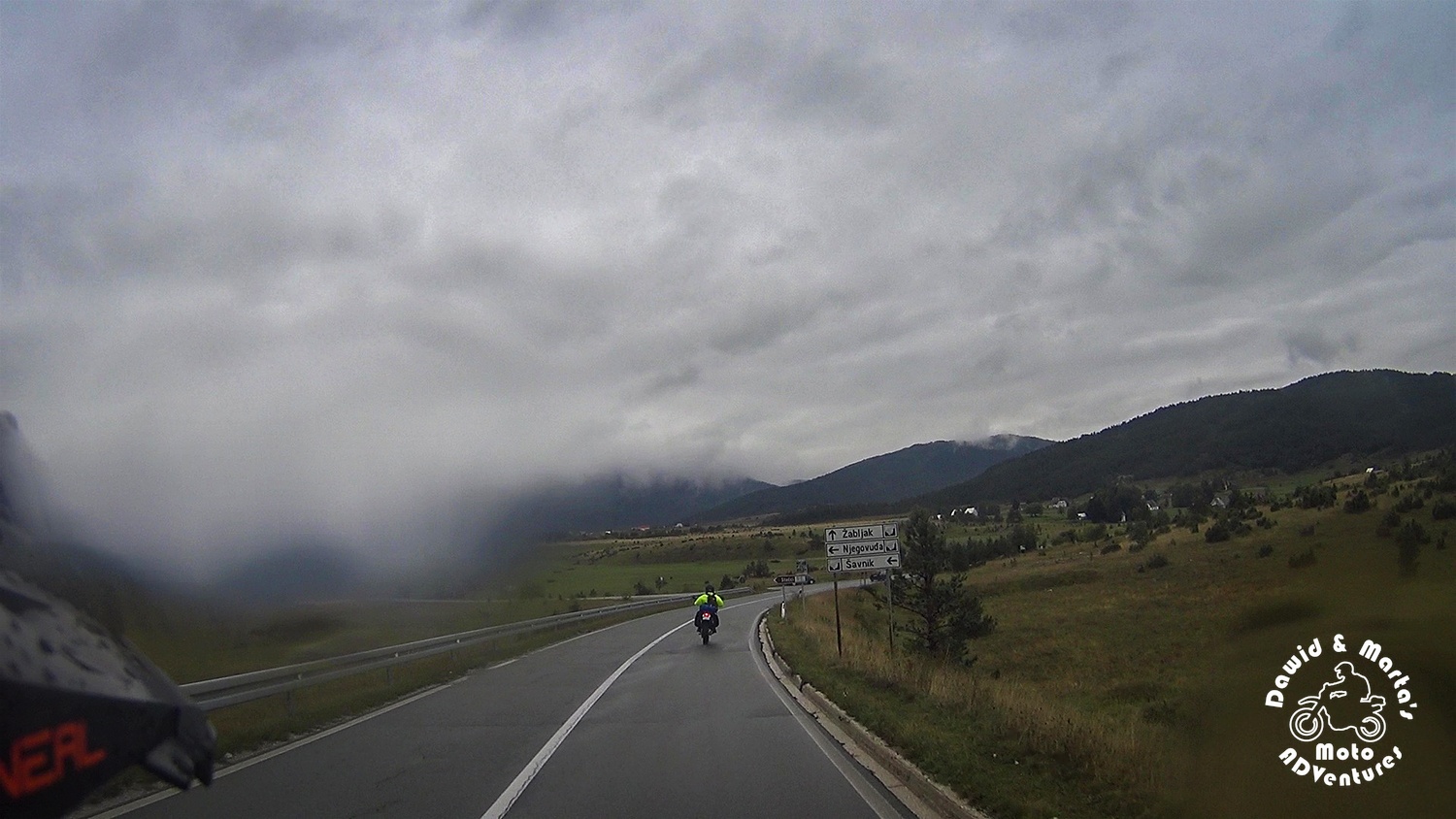
The capricious autumn Montenegro weather on way to Zabljak
When we were preparing for our motorcycle trip to Montenegro, we made a little research on the Montenegrin weather in September and beginning of October. We put a special emphasis on the condition in the Montenegro mountainous region as in the mountains the weather is rather harsher than at the sea bays.
We found that on average the temperature around (for example) popular Zabljak and Durmitor, varies between 17.0 to 27.0°C (62 to 80°F) an there are usually 7 to 10 rainy days.
So it sounded like we had a maybe 30% chance of riding all wet and cold. Seemed good. Yet…
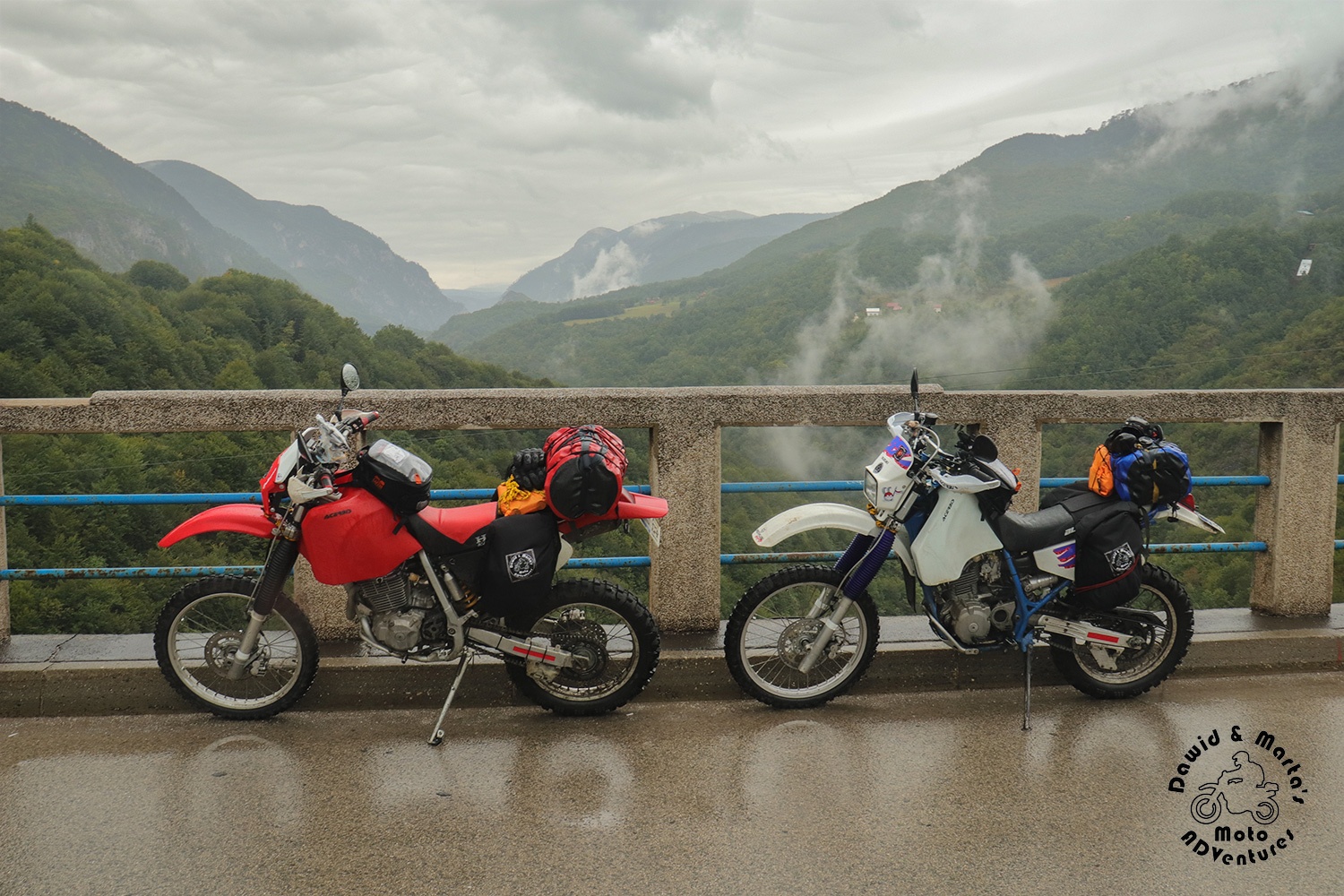
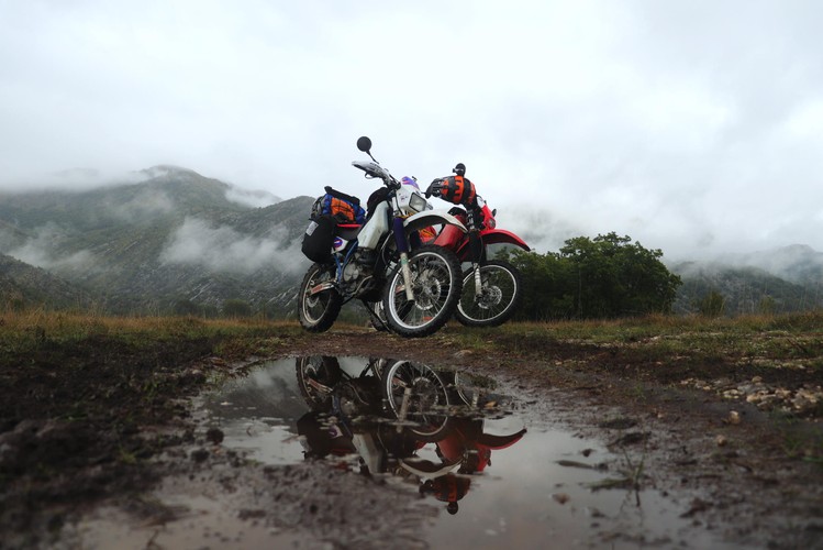
Montenegro greeted us with grayness, fogs and rinsed our bikes thoroughly with streams of rain.
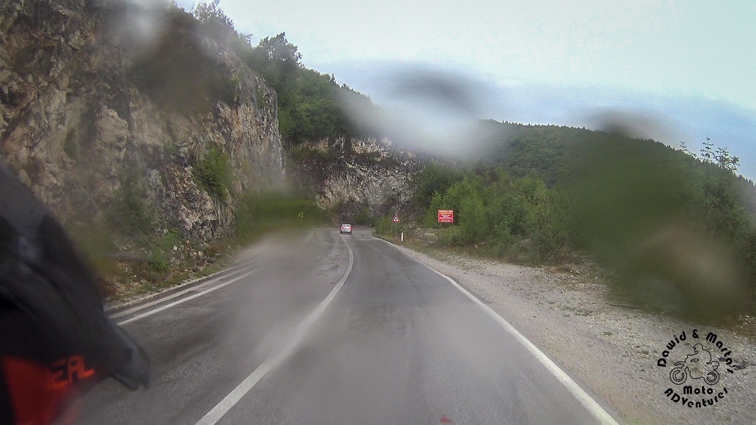
And judging from the tremendous temperature of 4°C (39°F), the clouds were sticking to the mountains ridges for a while already.
So in reality the statistics seemed to be a little cruel to us. As we were planning a Durmitor hike, we hoped for the weather change badly. With sarcastic smiles, though.
Our bikes were putting up with weather worse than we did. We had our outer rain suits, so we couldn’t care less for the water and coldness. (Those coats really do their job, even better than the waterproof membranes, which came with our motorcycle suits.)
But the bikes started to choke a little. The XR even to the engine death a couple of times. DR had only some problems with throttling – you could turn the throttle all the way and the bike was rolling like nothing happened. Until a second later. But that was just a short engine snap anyway.
We worried about this a little. However, in the end we think that were just carbs problems. The altitude (we were high in the mountains) and the low temperature combined could have been interrupting their normal work. The difference in behavior in DR and XR was probably caused by the different carb types.
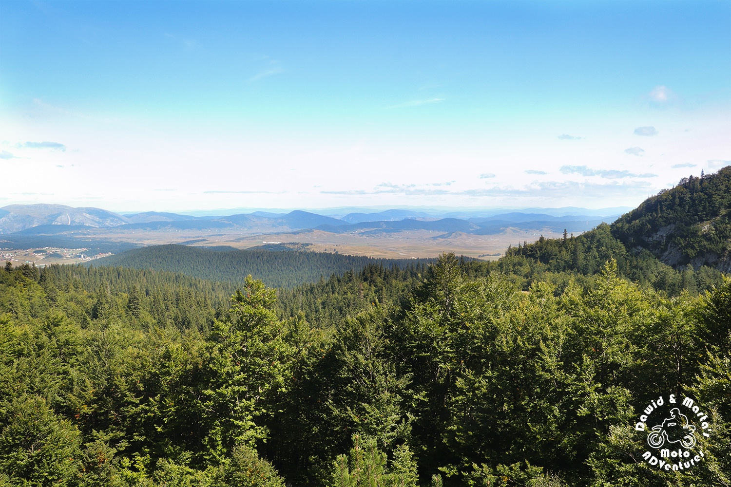
But apart from freezing hands and the carbs acting strangely at this height and not so optimal heat, the views were great.
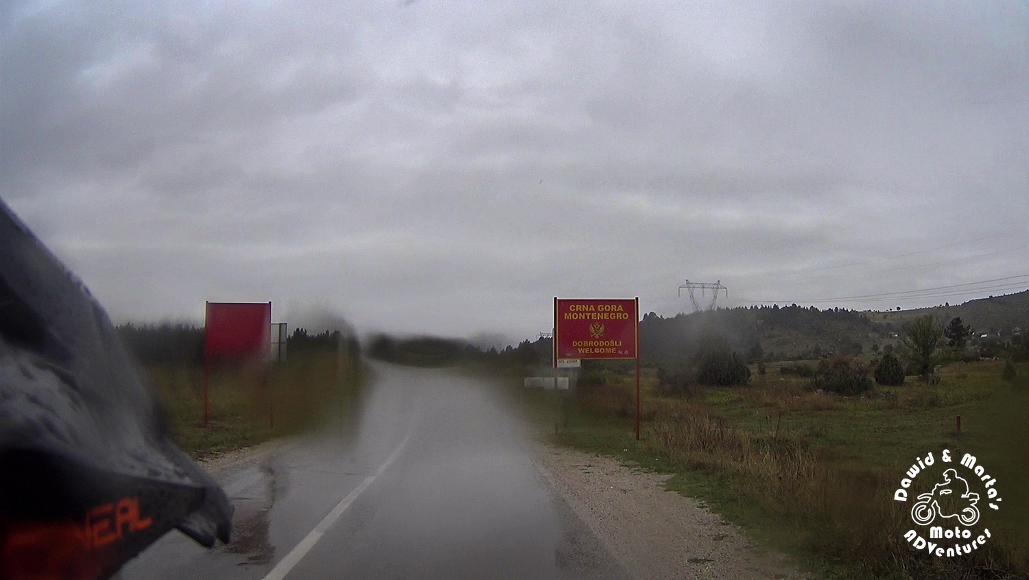
Methinks it’s worthwhile to get wet at least once and try to ride down from Rance to Zabljak through the P4 road, while entering Montenegro from the Serbia side.
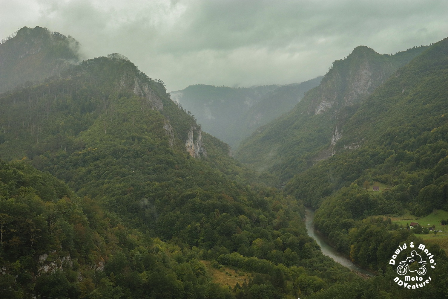
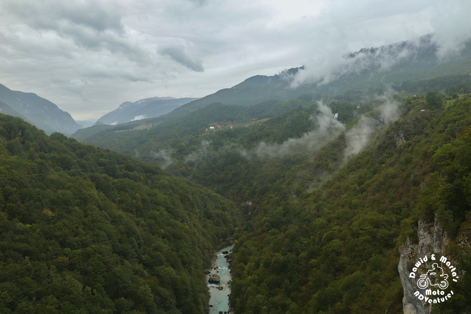
As I mentioned in the previous post, where I was recalling fun things we’ve encountered on our way to Montenegro, the season, weather and time of the day changes landscapes sometimes past all recognition. We regretted nothing.
Beside the awesome mountainous scenery playing hide and seek in the fog with you, while you ride up and down, trying to not fall out the road’s mad turns, the P4 road from Pljevlja also leaves you with no option than to visit the Đurđevića Tara Bridge on the way to Zabljak.
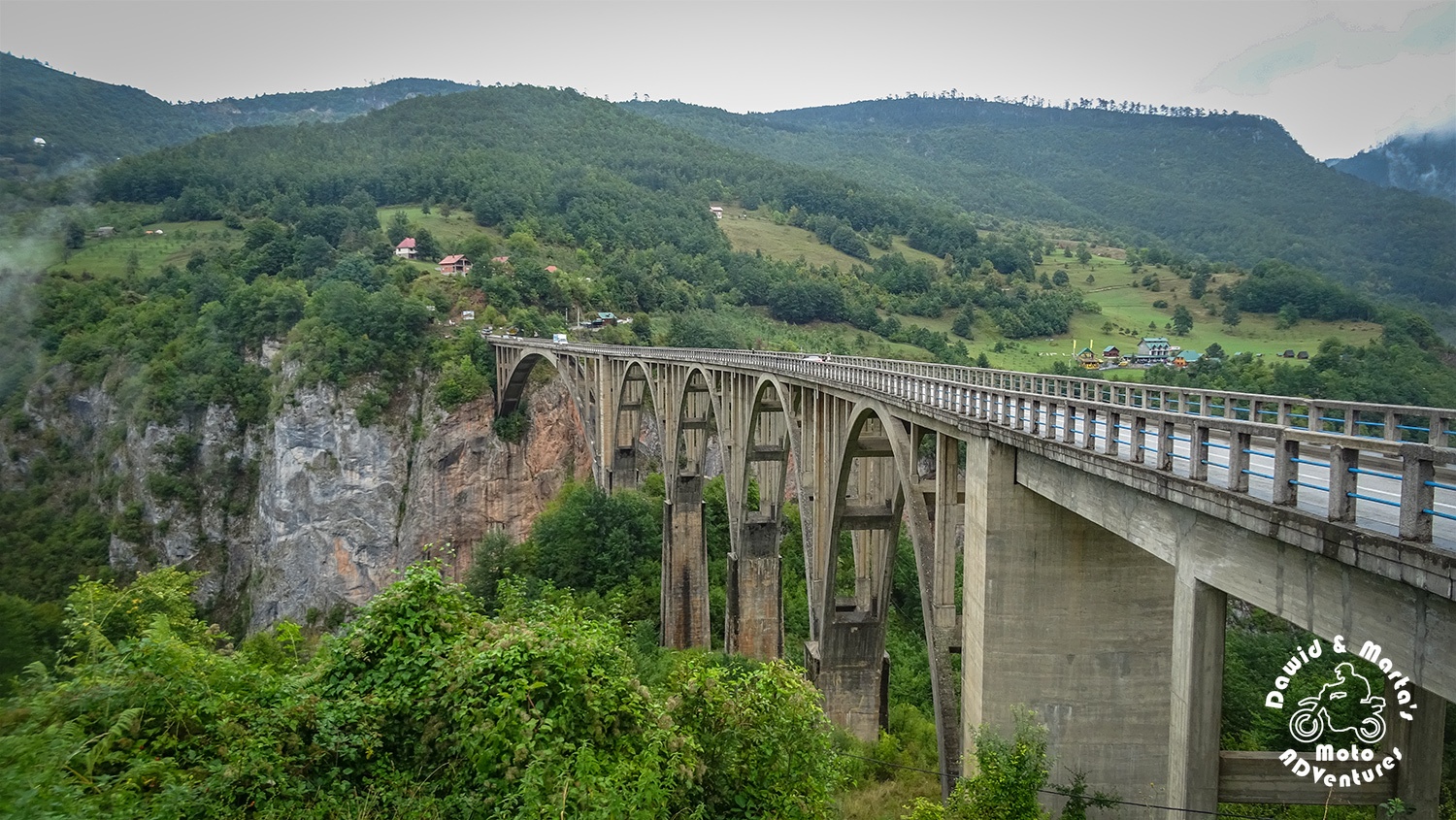
If you ask me, the bad weather actually makes the views from bridge even better ;)
The tourists traffic in that very popular spot was also lighter. So I guess the end of September is really comfortable for those, who don’t like scampering in the crowds. We visited the Tara Bridge before in August, 2 year ago, and the difference was noticeable. There were really less people walking the bridge as well as there were no buses struggling with parking or cars from the zip line companies cruising around.
Though, there is another fun way for entering Montenegro is from the Croatian side in Konfin. There you can start from exploring the Kotor Bay – check this post.
Camping in Zabljak
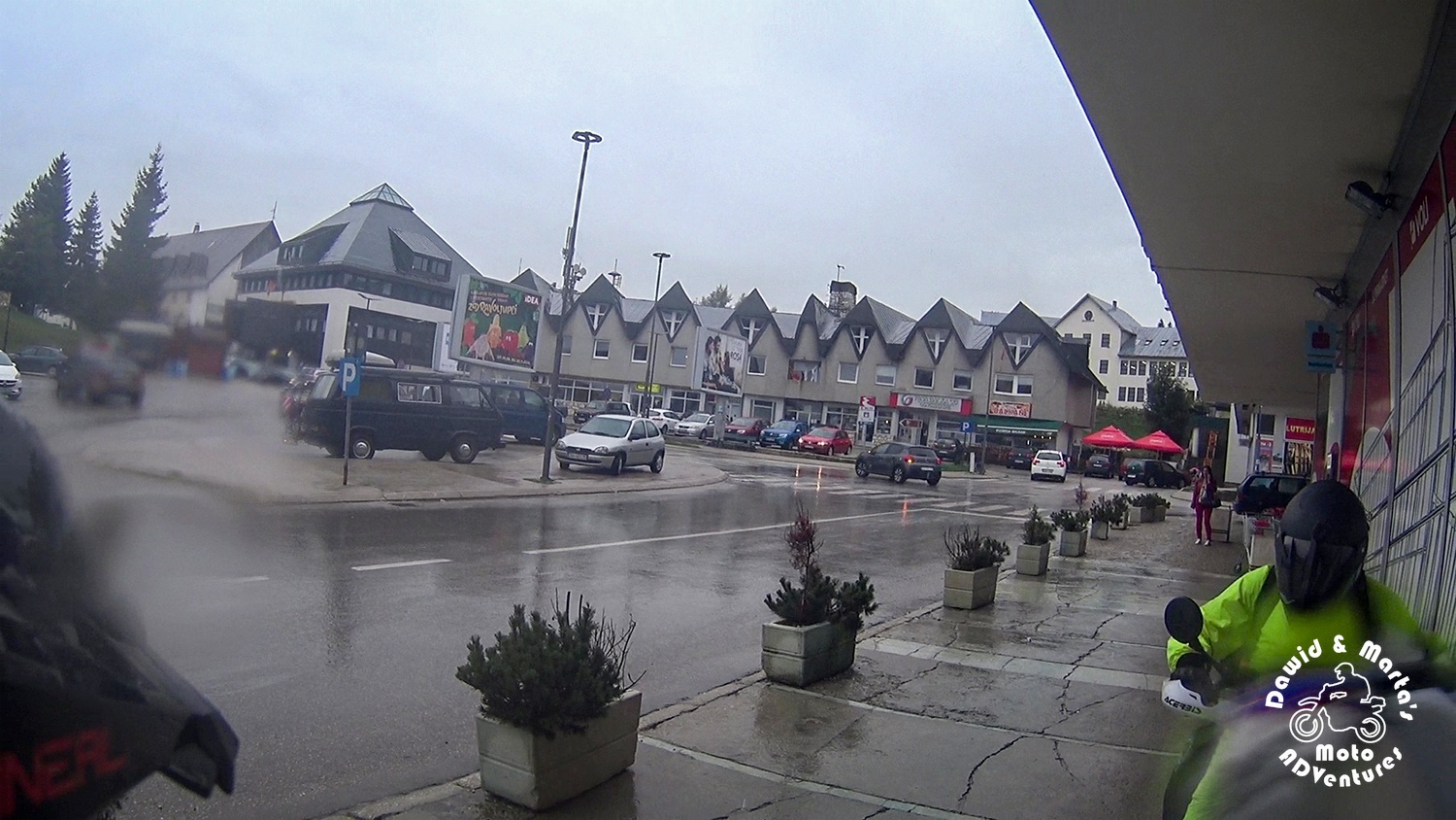
Just as we entered Zabljak, we made small shopping at the local bakery Toni and in the market.
Yes, you might complain that we didn’t check out any restaurant, but hey! Guess who bought tons of huge, greasy bureks and extraordinary sweet baklava? \(♥‿‿♥)/
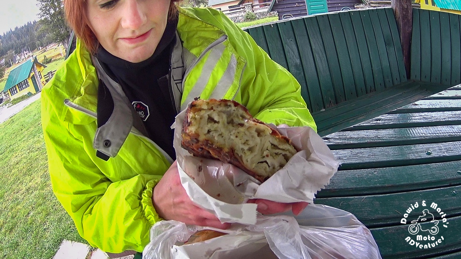
Yes! We did! ;) (And we recommend you buy all the bureks too!)
As the weather was awful and the day was late, there was no time for hitting any trail that day. So we headed to camping and hanged there till the next day.
There isn’t anything interesting to see in the Zabljak city center if you’re an historical or architectural freak. Zabljak is mostly a base for tourists hungry for mountainous views.
Be it watched from the Durmitor mountains feet perspective on a small road trip around the Durmitor National Park or from the rock giants peaks point of view after long hiking.
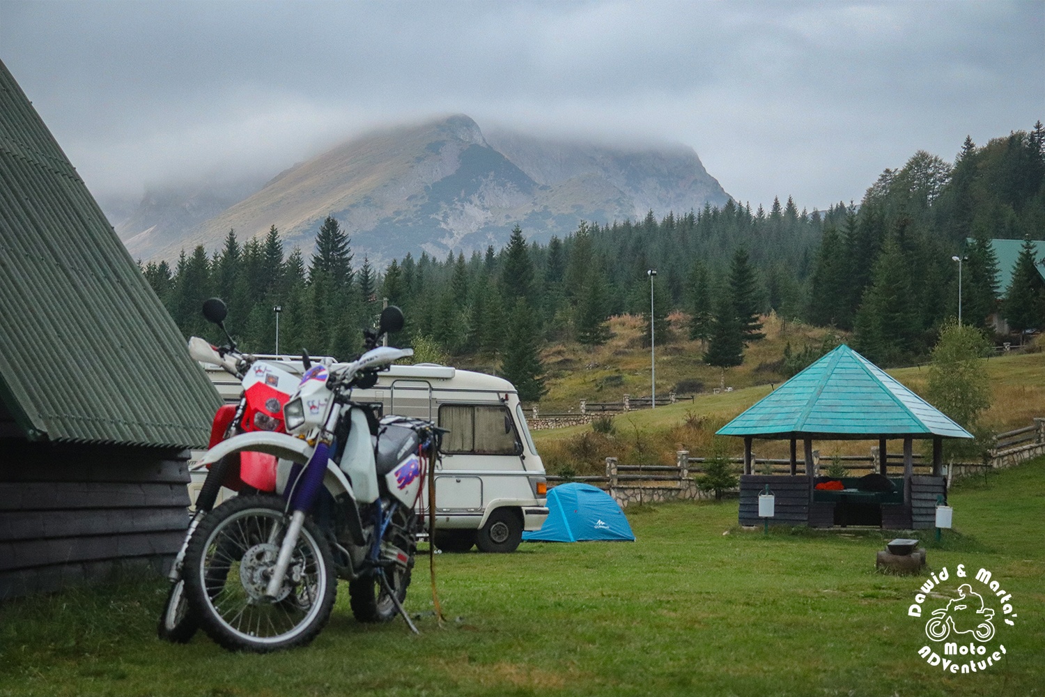
We chose Auto camp kod Boce for our base camp as we’ve been there already two times and we were always leaving content.
Camping is clean, you can use pots and fridge in the kitchens for free and the owner is nice and always helpful, either if it comes to some usual tourists information or asking for less ordinary tips on hiking or camping in the wild. (The lady saved us with two beers once, when we came so late, we wouldn’t get any until the next day as all the shops were closed!) The only cons is the water sometimes. Likes to get cold as it is only heated by solar panels.
But if you decided to go camping there in the cold mountains, even around the normal facilities, then you’re a tough one anyway :P And were else will you get a view on Savin Kuk just at your tent’s entrance?
The camping might seem placed far from Zabljak center, but you can make a nice 5-10 minutes long walk by the forest and you’re just right at the market, bakery and surrounding it restaurants.
We had all this and a bungalow for 8 euros per person. So I also think the prices are really fair.
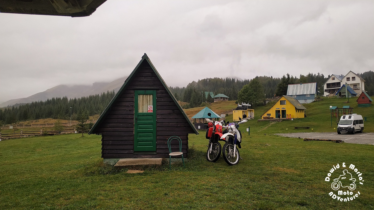
The camping was a little desolated because of the season end (it was 19th September that day) and who ever was left there alive, hanged in a camper or tent in that nasty weather. The camping owner confirmed that it was raining a couple of days now and destroyed our little hopes for better by saying that the weather forecast for tomorrow isn’t any better. We didn’t want to run away to the Kotor Bay coast yet, searching for the last sun rays, so we just kept our fingers crossed and tried to get warm and dry.
When we got up the next day and peeked outside…
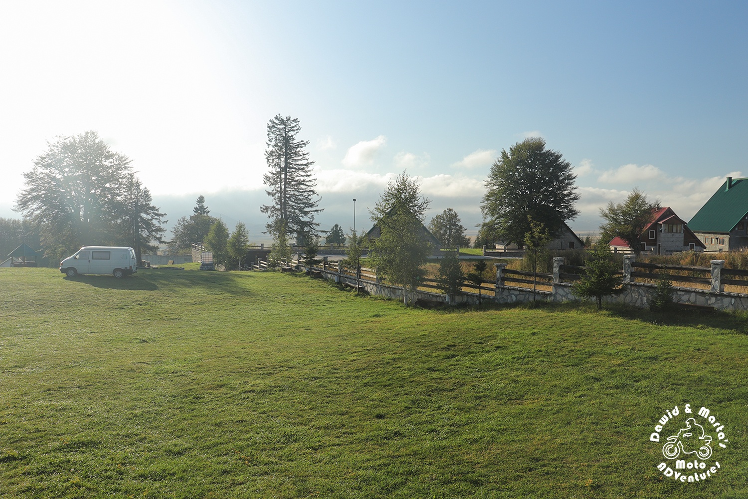
The weather changed completely!
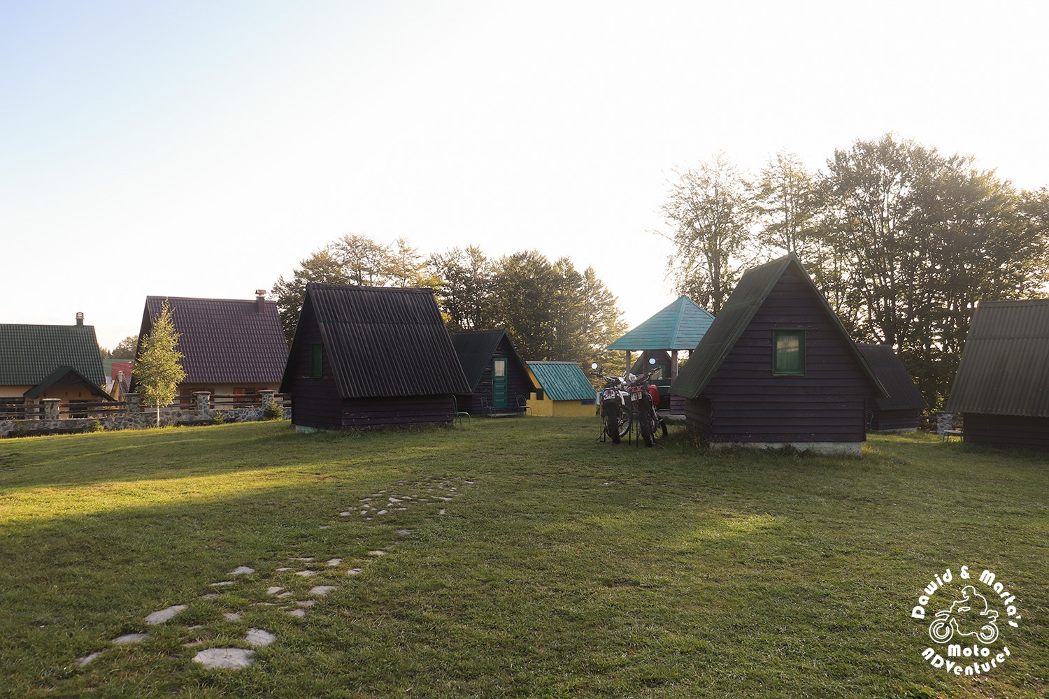
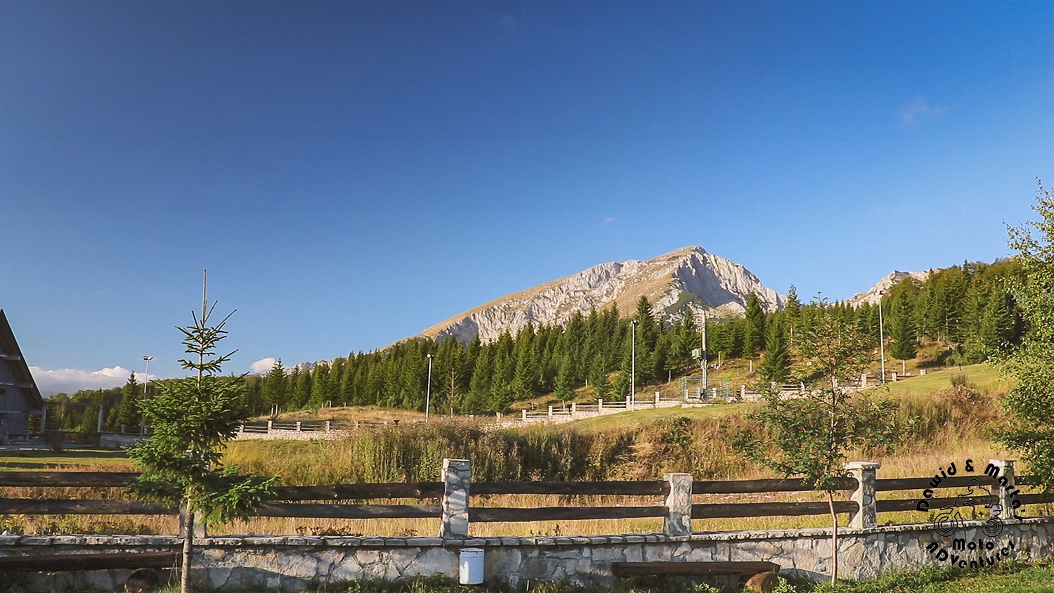
It was still cold, but the sky was crystal clear. So immediately we started to get ready for hiking to this big guy:
In search of the trail to the Savin Kuk peak in Durmitor National Park
We planned staying around Durmitor for 2 days, actually, praying the next day’s weather will be sunny as well, so we could check out two trails through Durmitor during our stay.
For our first trekking day, as I mentioned earlier, we chose the 2313 meters (a. s. l.) high Savin Kuk.
To get to its top all the tourists guides and maps recommend to take a path through Mioč Poljana or even by car through Moticki gaj to get to Ski Center Savin Kuk in Poljana. From there you can ride to the Savin Kuk’s top by the ski lift. Or to walk by feet like that:
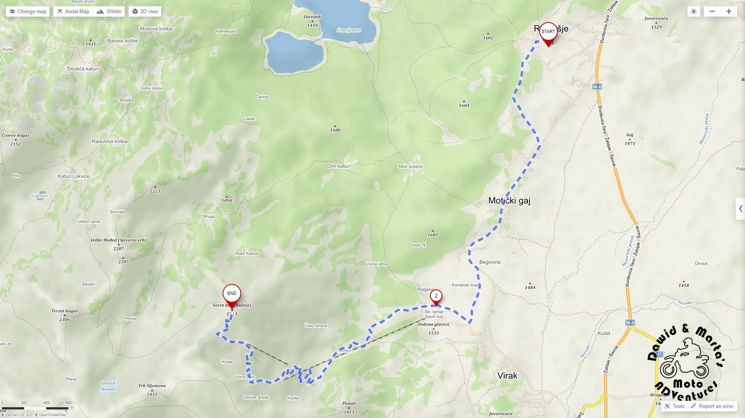
If we would choose this option, then it would took us 7.5 km of walking.
But thanks to the awesomeness of the maps you can find at https://en.mapy.cz/, we found out that we can make a nice 13.6 km long trek looping around the Savin Kuk top. It seemed a nice option as we wouldn’t have to track our footsteps back to the camping:
I think it seemed like we have 8-10 hours of walking, but we prepared ourselves good.
We got into our trekking shoes and packed additional clothes in case it would get colder or somehow it would start to rain. You never know how the mountains mood will change.
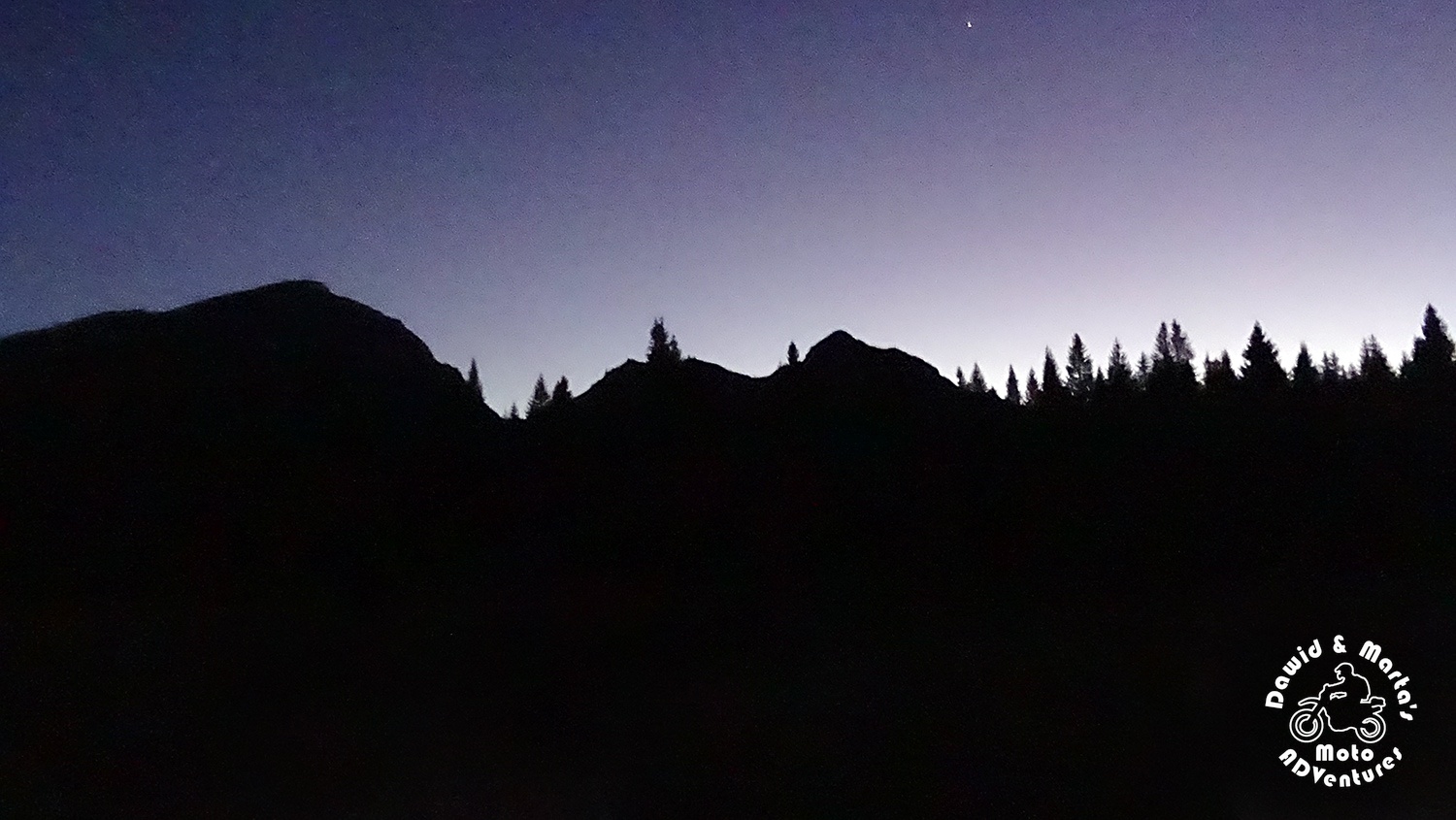
But, of course, the things of utmost importance were the flashlight and the headlamps. It was a little past 11 AM when we started our way up. (We started off late, as we also made a walk to Zabljak for some provision, so we would not starve or die from thirst along our journey up. You gotta do what you gotta do…) So we expected we will be coming down in dense darkness, as at the end of September the days are already shorter than during the Summer. It was getting dark around 6 PM and we didn’t want to call the Durmitor’s mountain rescue.
We also downloaded the maps from mapy.cz, so they would work perfectly offline on one of our phones.
Yes, mapy.cz can do that, contrary to Google Maps :P This is another pros of these maps, beside the marked tourists trails, mountain peaks, water sources, sheds etc. So we can recommend them without any regret (no, this article is not sponsored :P)
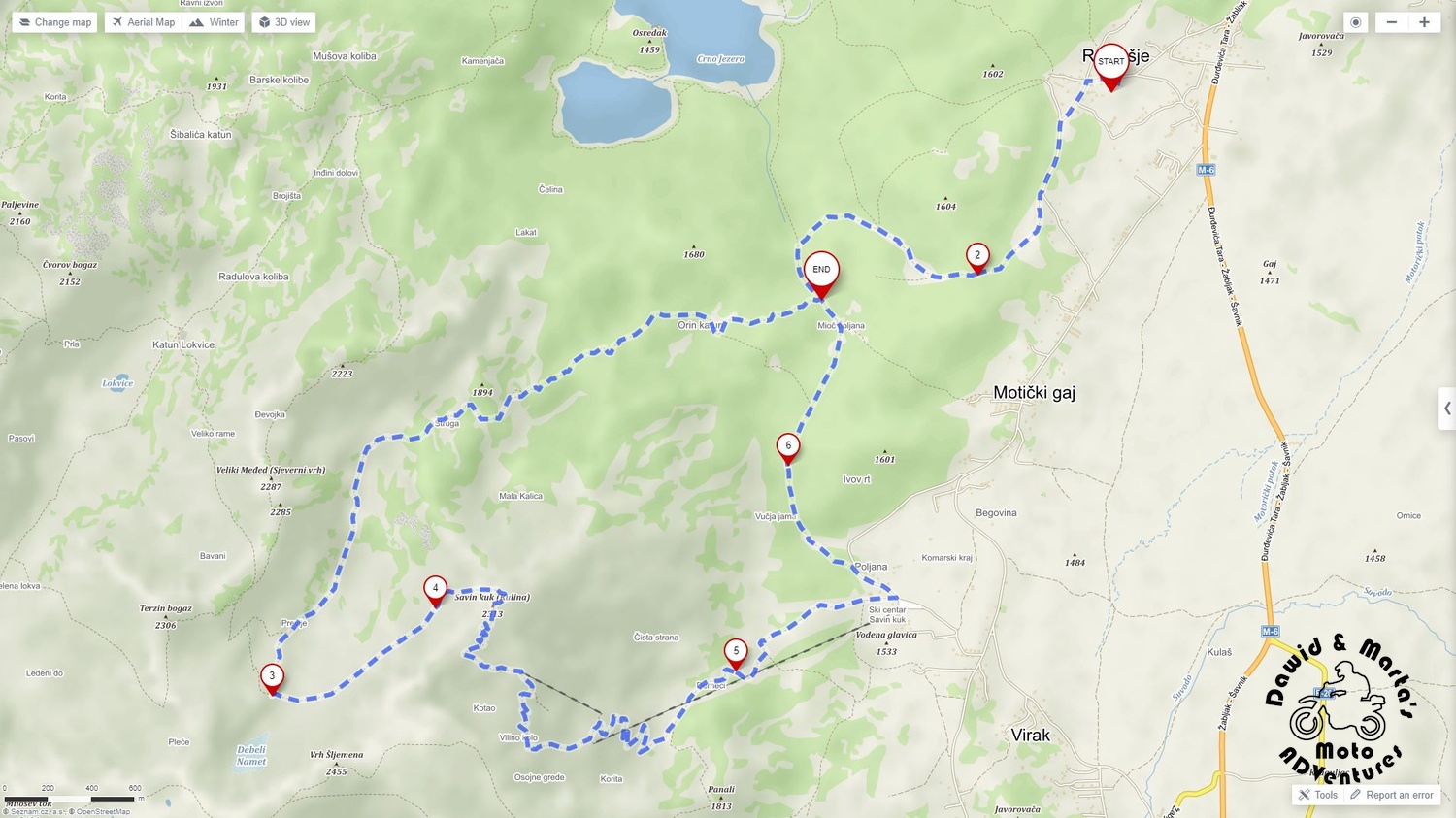
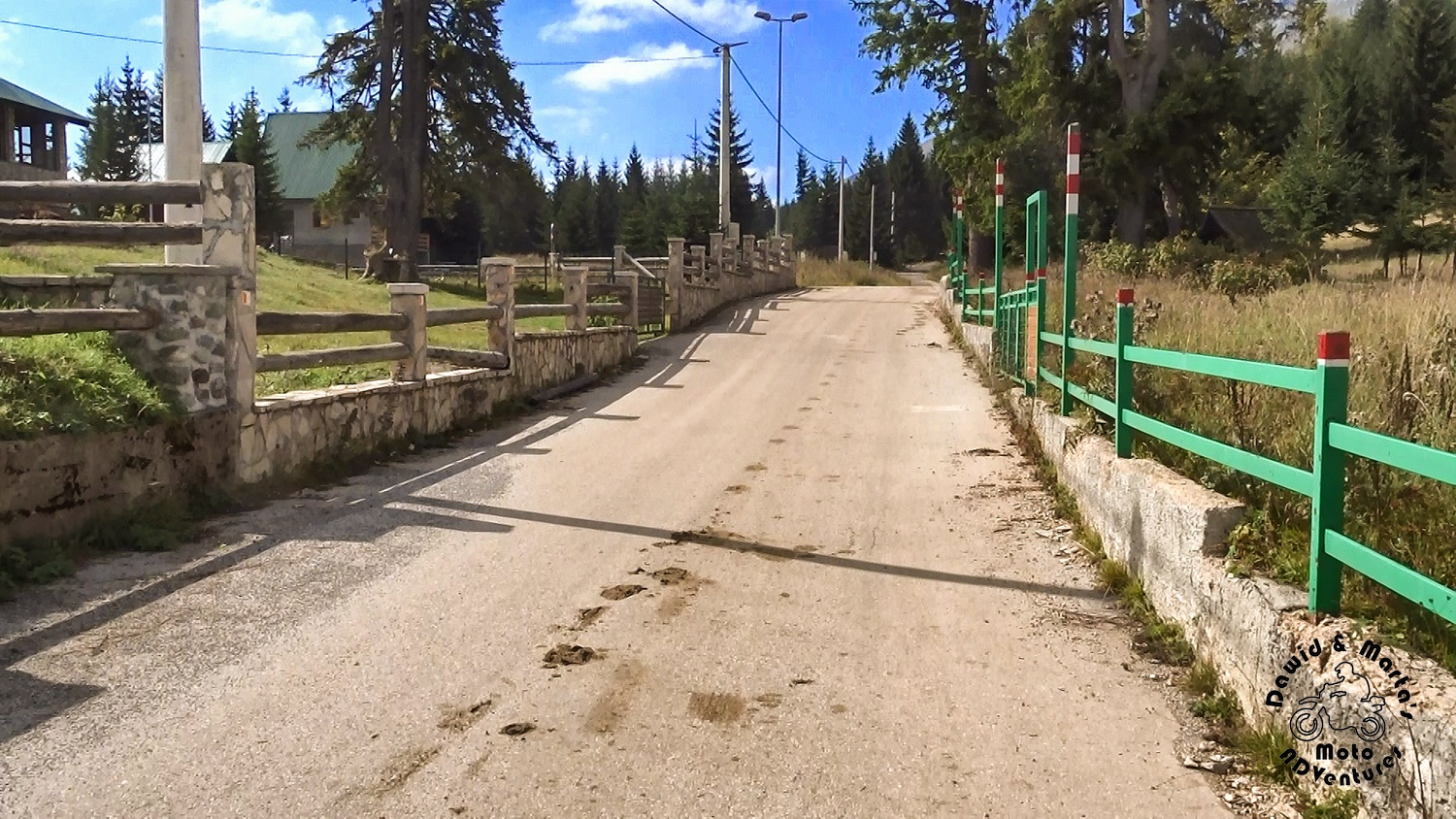
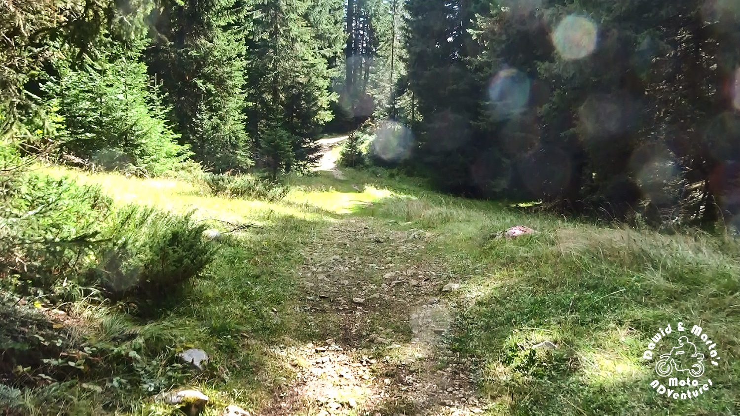
Moving out from Razvrsje to Mioč Poljana
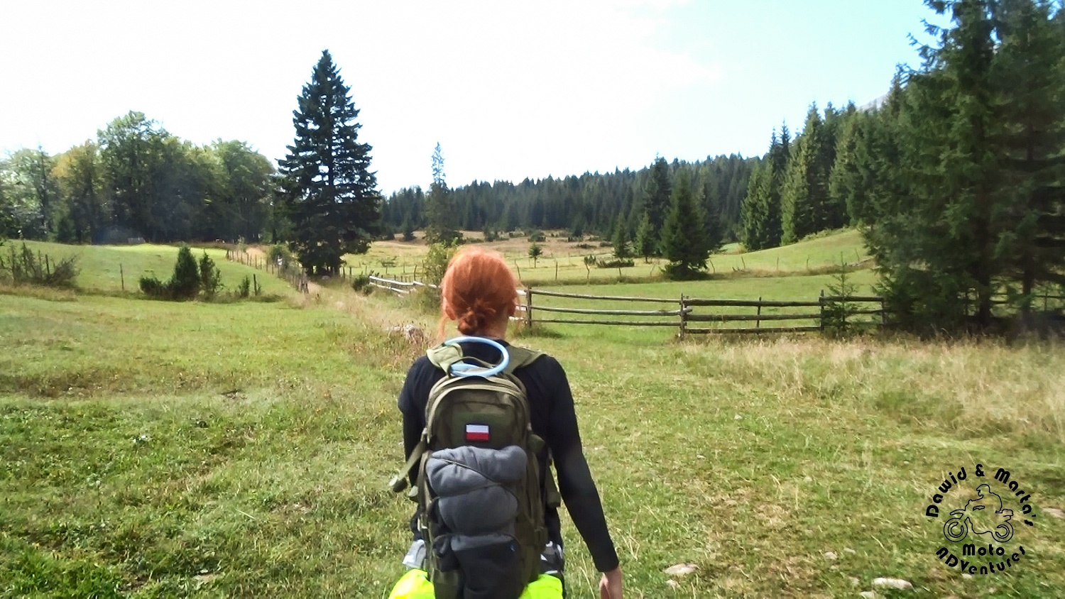
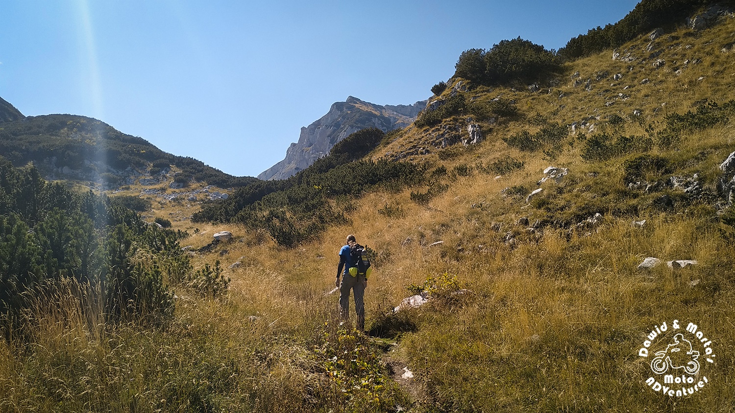
We started our hiking adventure at our camping. From there we got to the actual trail on feet just after dozens of meters. It began just behind the last Razvrsje houses.
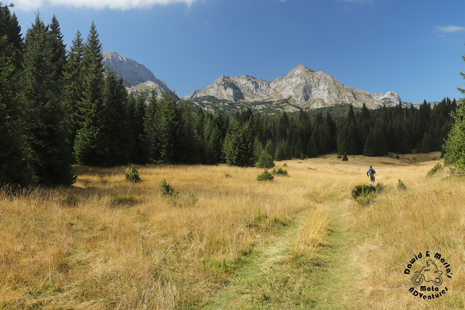
From there on we covered the greenish, empty pastures, which then gradually were changing into plains of golden meadows with isles of coniferous forest.

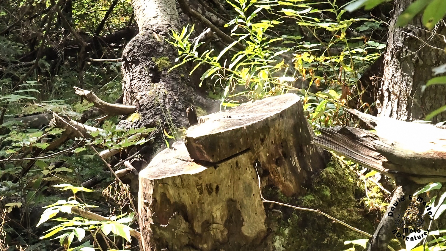
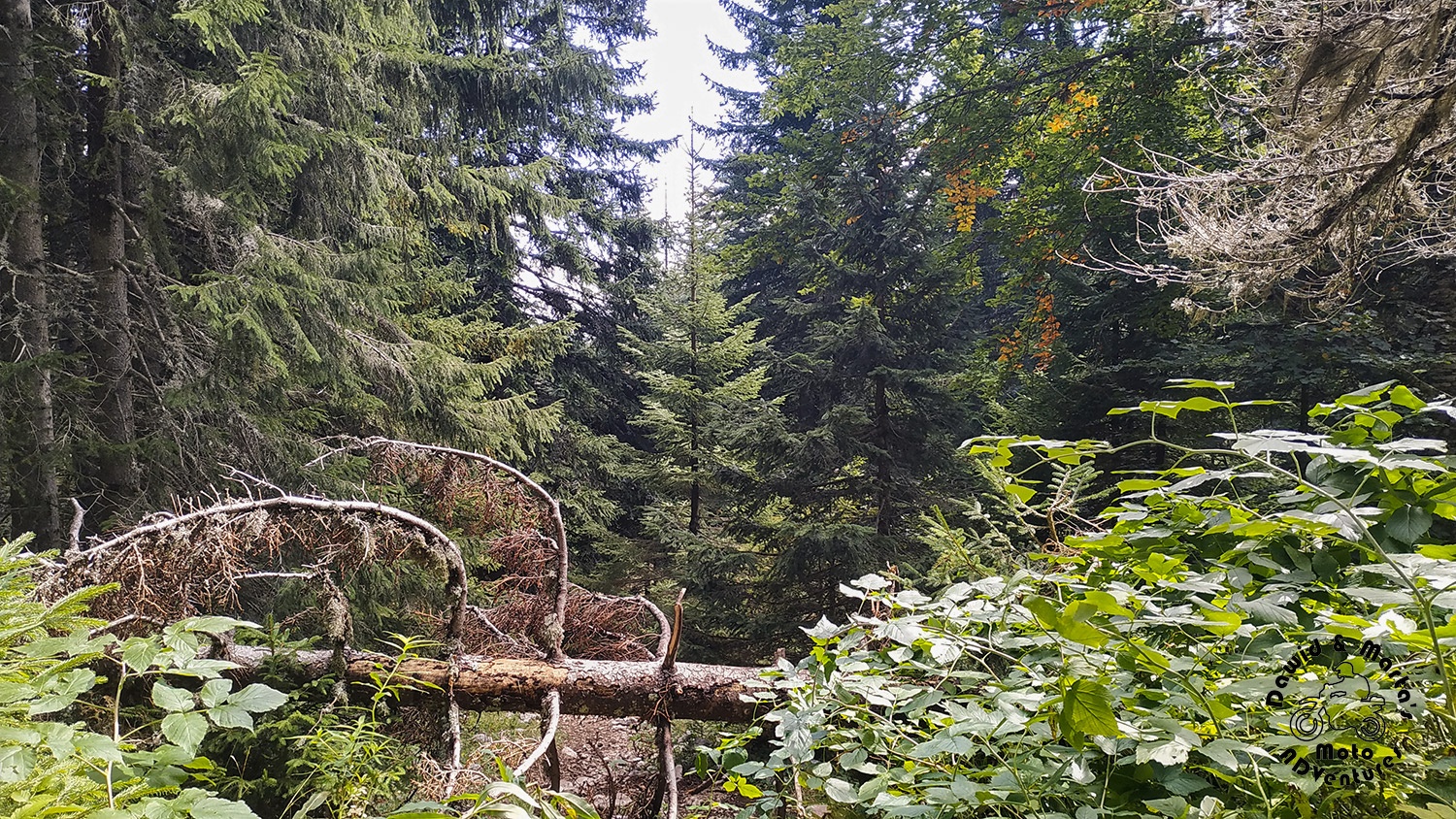
The forest sometimes hid some weird artifacts…
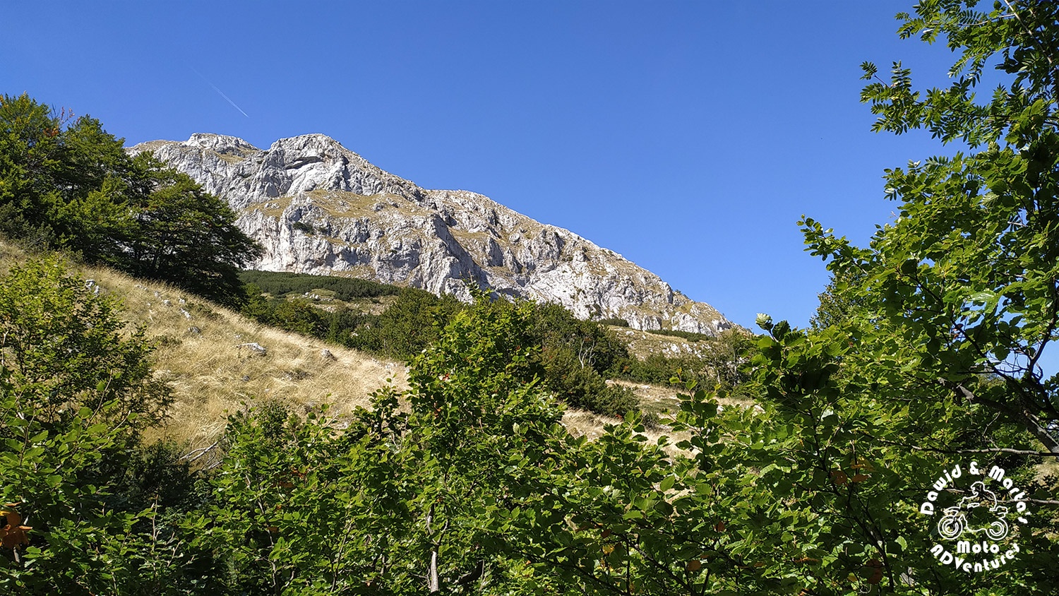
… As well as the mountain peaks.
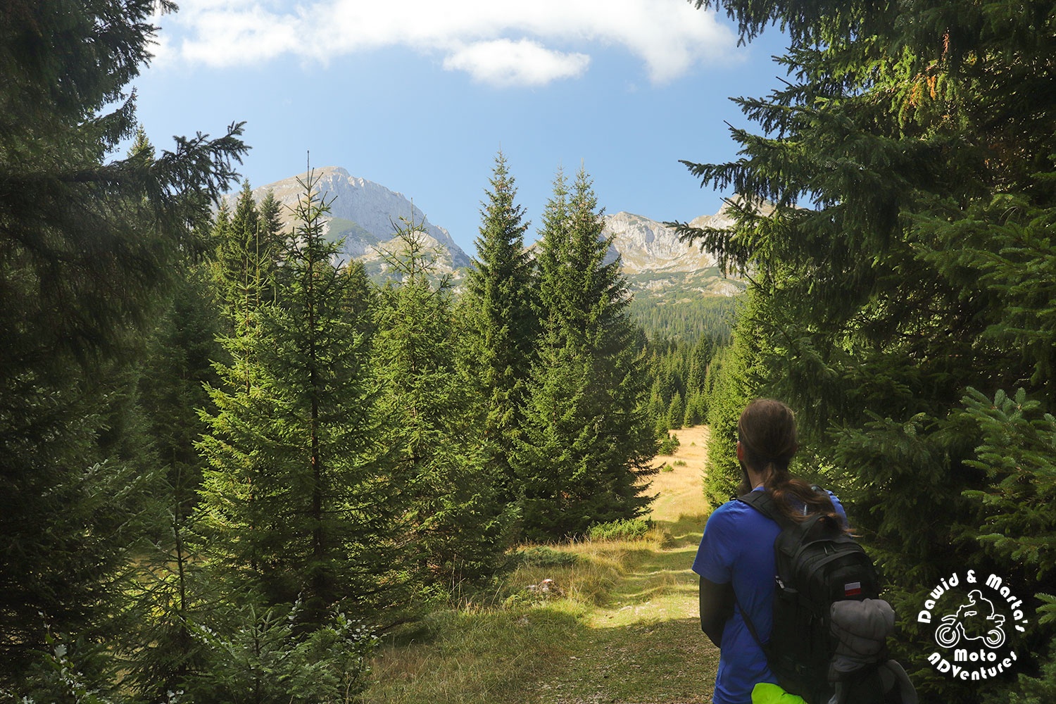
But as we got closer to the first trail crossing, meadows got more vast and we could now see not only Savin Kuk peeking from behind the trees, but also Veliki Meded and Mali Meded mountain tops.
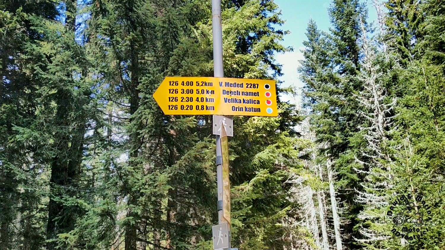
The crossing had a sign denoting paths well, so we got no problem here, where to go.
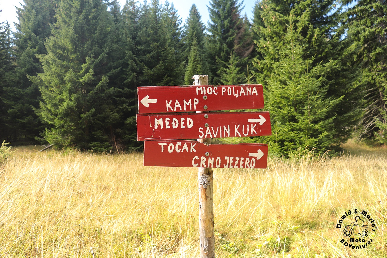
From there we made a short walk through forest to another more complicated for us crossing. Not that it should be hard to find the signs which you should follow. They were plain to see. But they were directing us to go through the usual track by Mioc Poljana. And we wanted to do our loop passing by the Savin Kuk top from the other side, with Orin Katun lea and Struga Pass on our way first to cover, remember?
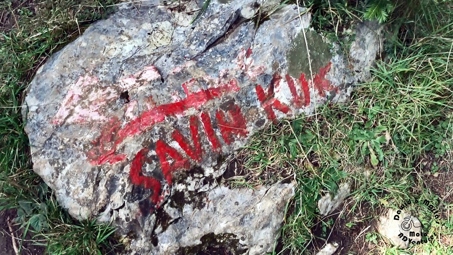
Actually, there was nothing about Savin Kuk peak on the sign pointing to the path we wanted to choose.
But hey, we thought to ourselves that our map can’t be that dumb to lead us through some impassable sections, like vertical rock walls, right? So maybe the marking is wrong? Or maybe there’s an unofficial path of some sort, but not too harsh?
And so we chose as we planned from the very beginning. We turned to trail to Orin katun, though there was nothing about Savin Kuk that way on the signpost.
From Mioč Poljana to Struga pass
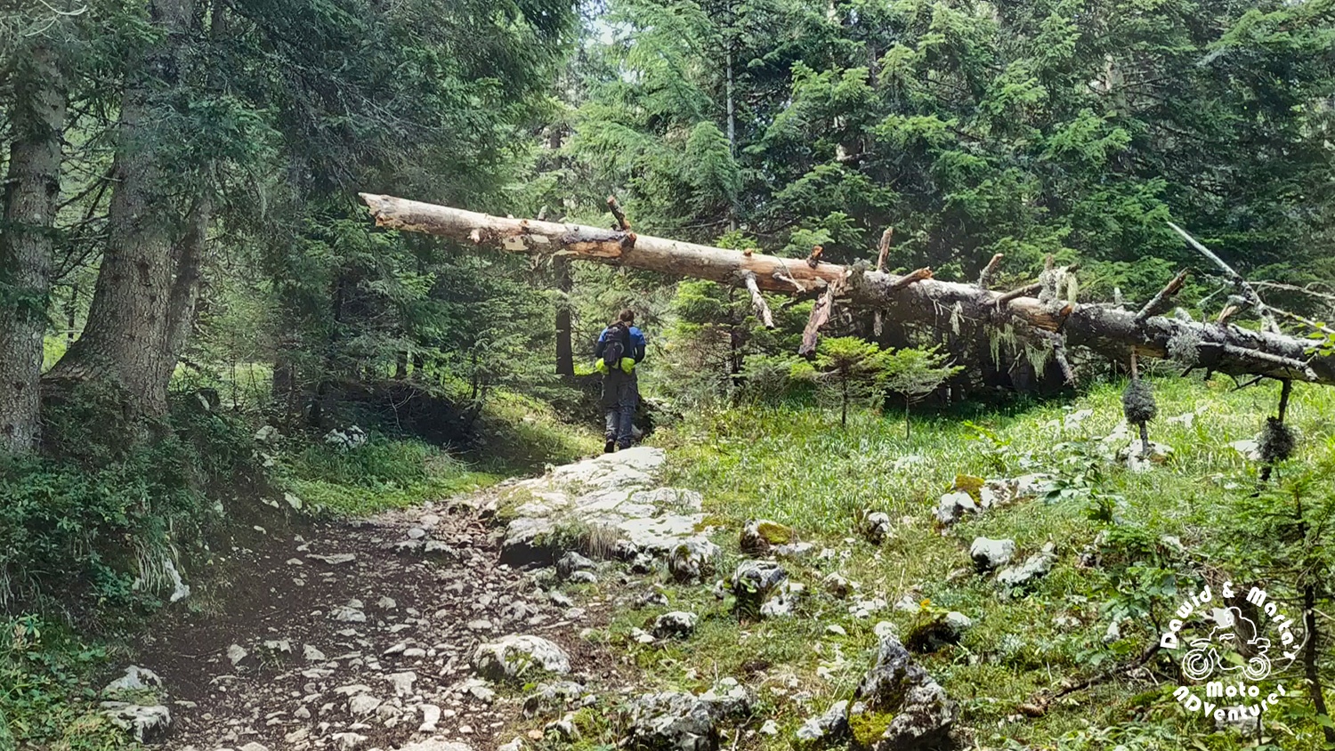
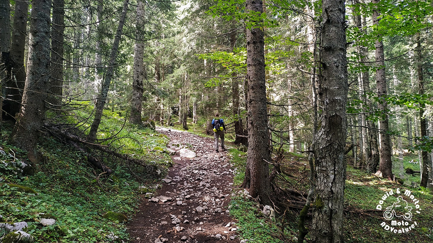
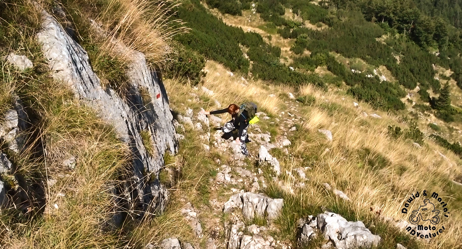
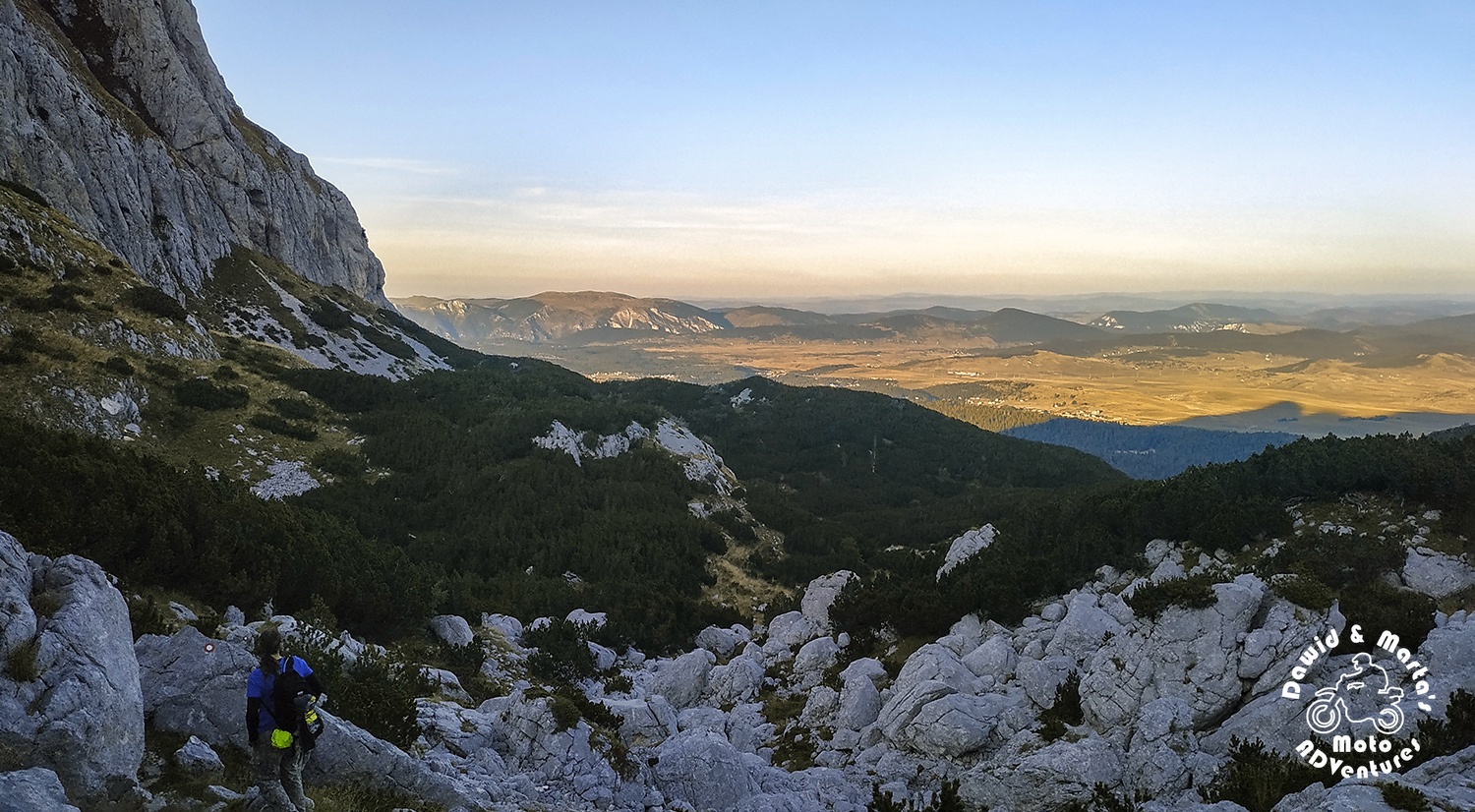
The path of our choosing led us mostly through the dense and quiet coniferous forest, rustling in the wind and filling our heads with the resin scent – almost until we reached the Struga pass.
There was nothing much to see through the branches. There were only them, standing dumb, and we, chugging and struggling to go uphill. It might look like an easy, plain walk, but the photos we’ve made on this section don’t reflect the slopes you had to deal with sometimes. Though it’s not that it’s a hard track. But it’s a nice test for your condition level.
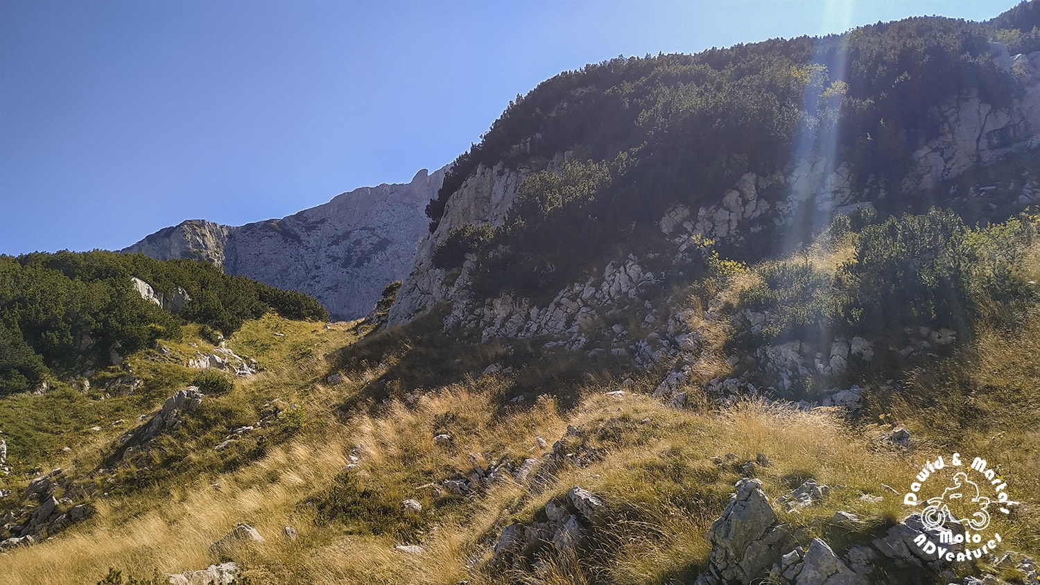
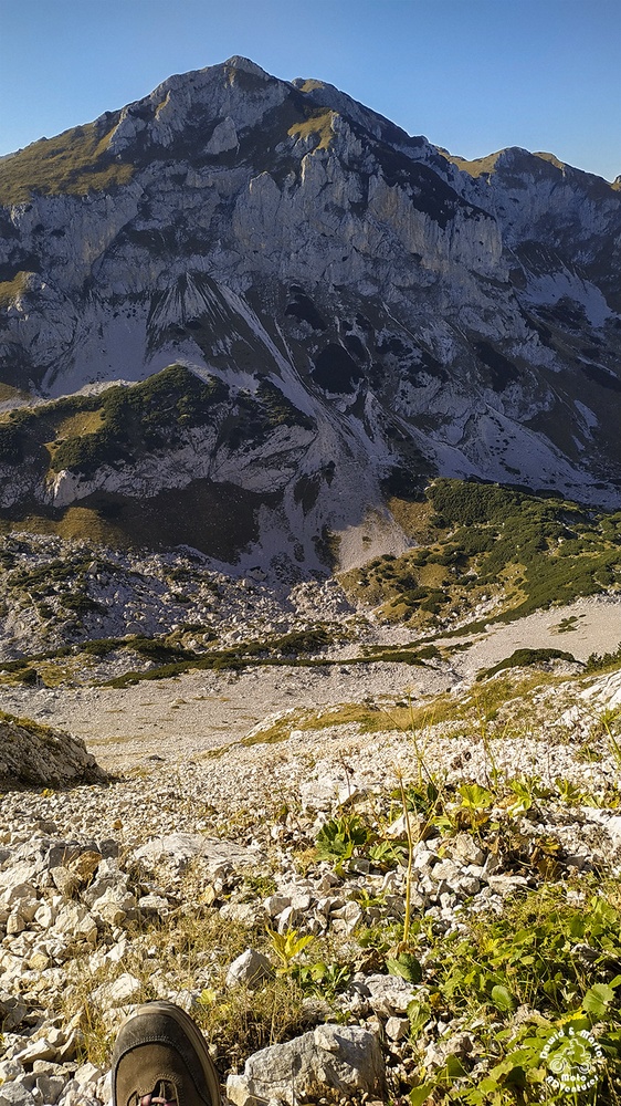
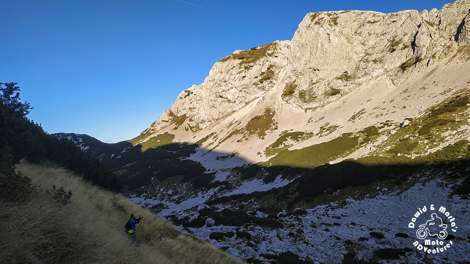
Around 1800 m a. s. l. the trees start to thin out, so you can again see the rocky monstrosity looming at you from above and take a look behind your back to see, how high are you, actually.

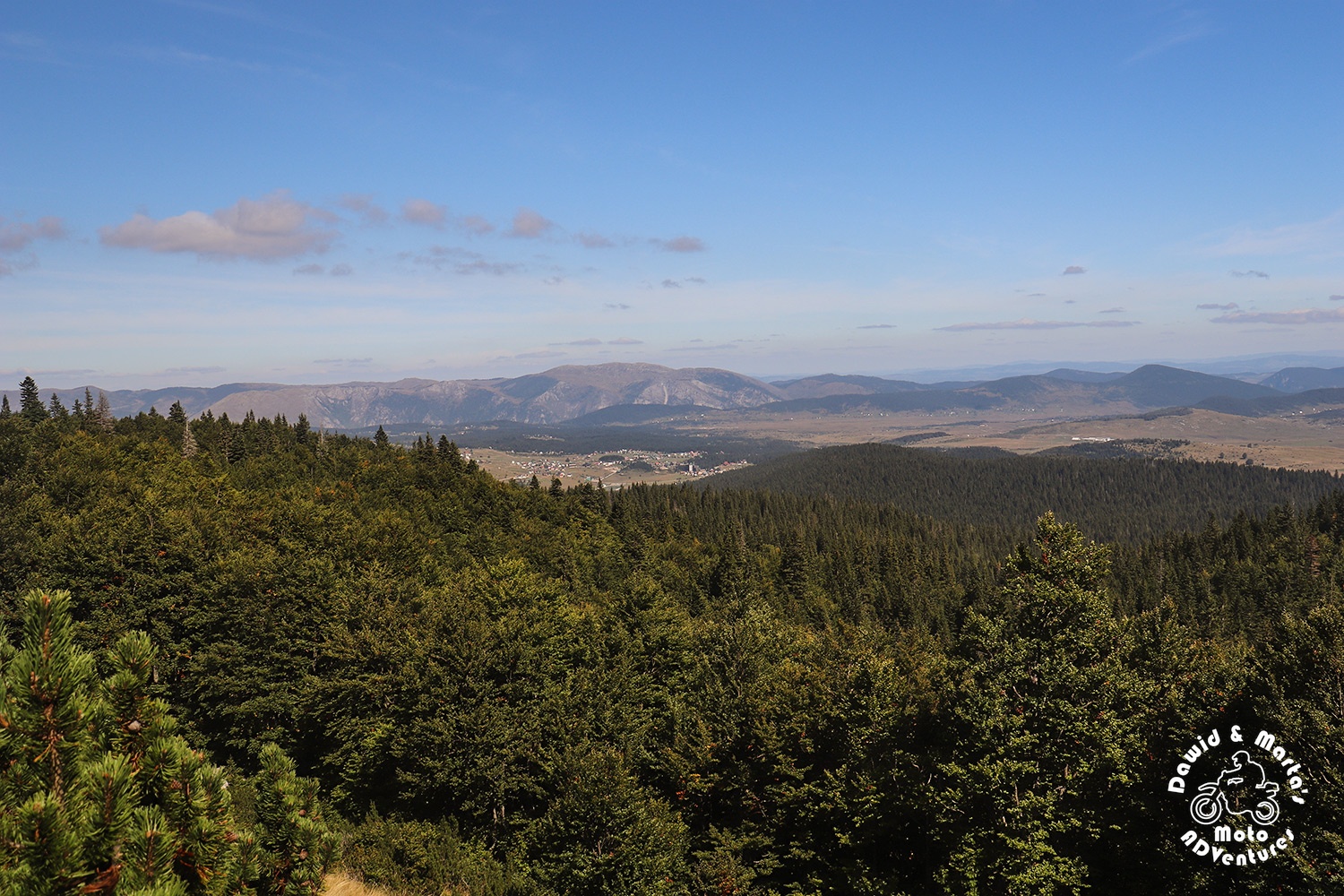
From there on the trees make place for the green walls made of mountain pines, which then open to the rocky plains covered with golden grass. The track itself goes even steeper here sometimes.
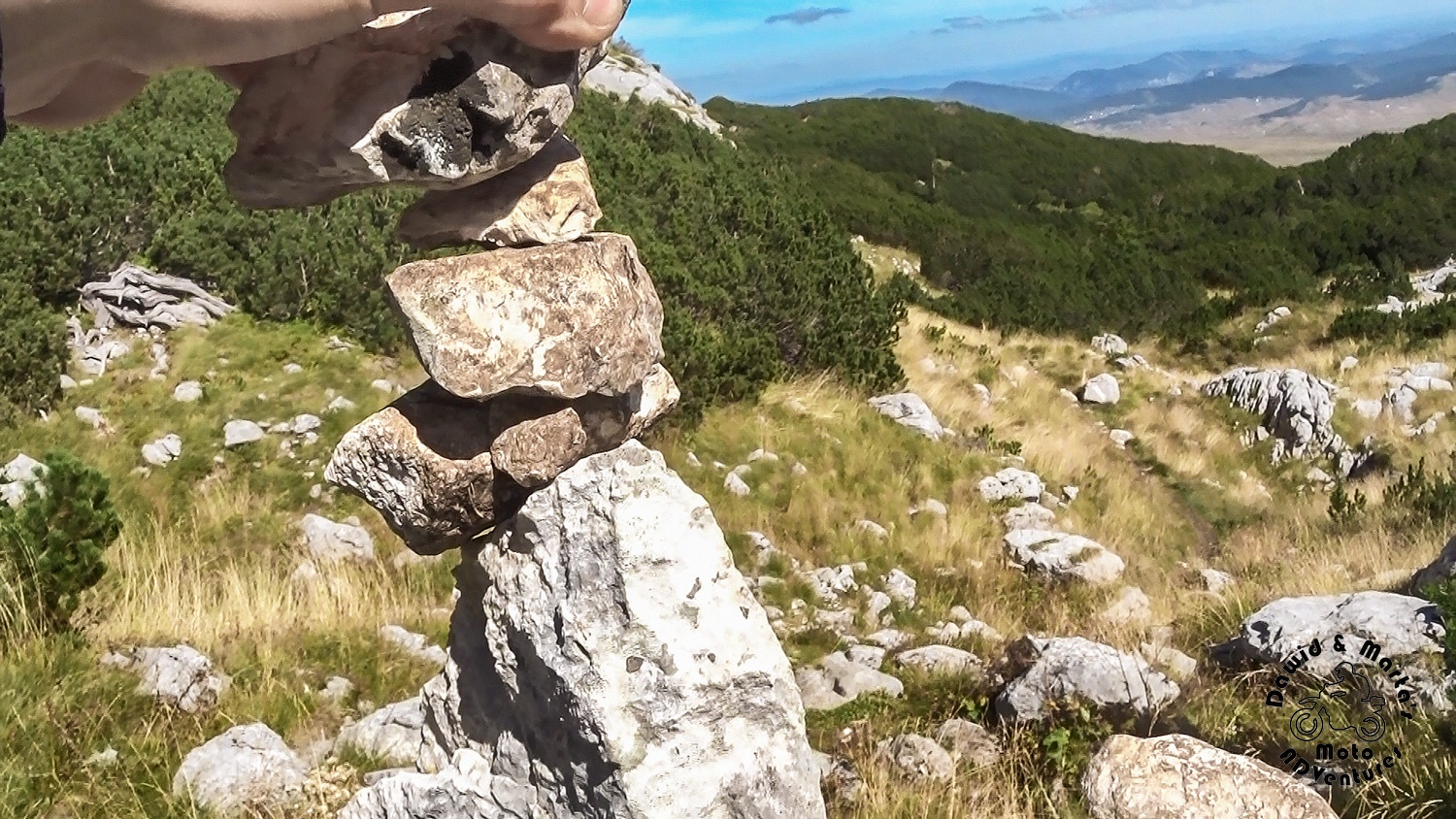
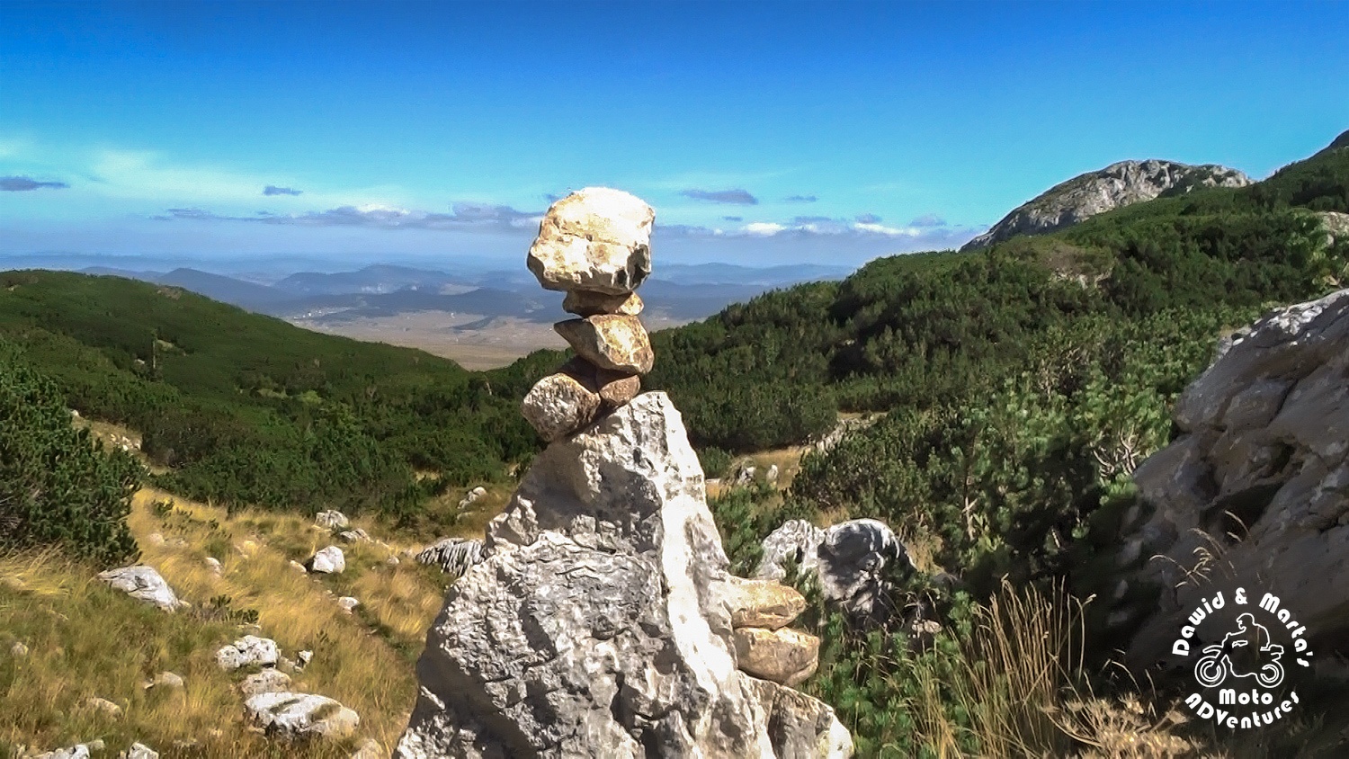
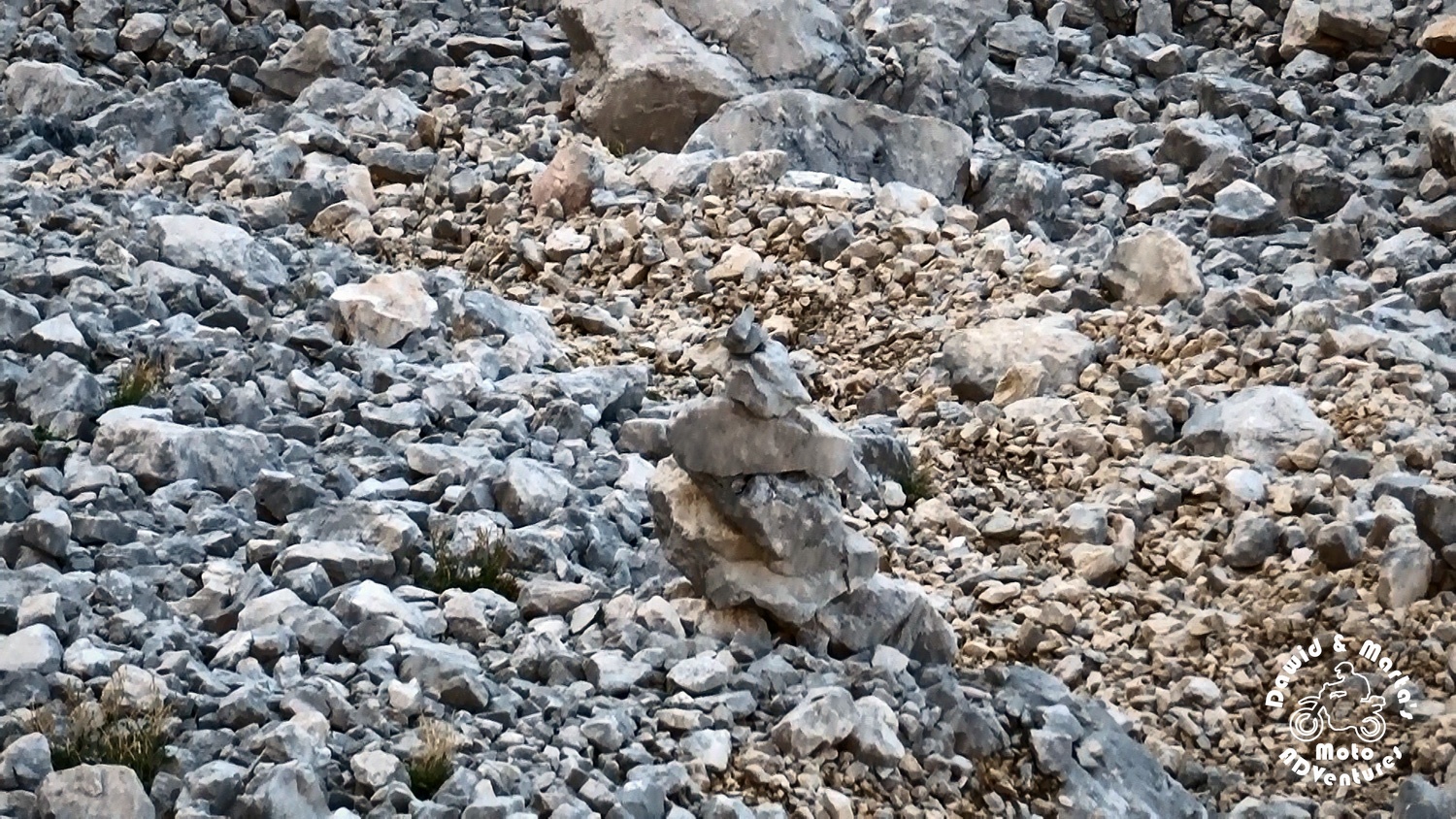
On the way we found a nice accent – small towers made of stacked stones, marking the trail and maintained by the other hikers.
After some sections with more climbing required, it generally leads further through the more even Struga pass and makes the walk more pleasant for your respiratory system and hypnotizing for the eyes. The high, yellow grass growing here everywhere turns it color to gold in the sunlight and I swear it even glitters, when it bends under the wind blows.
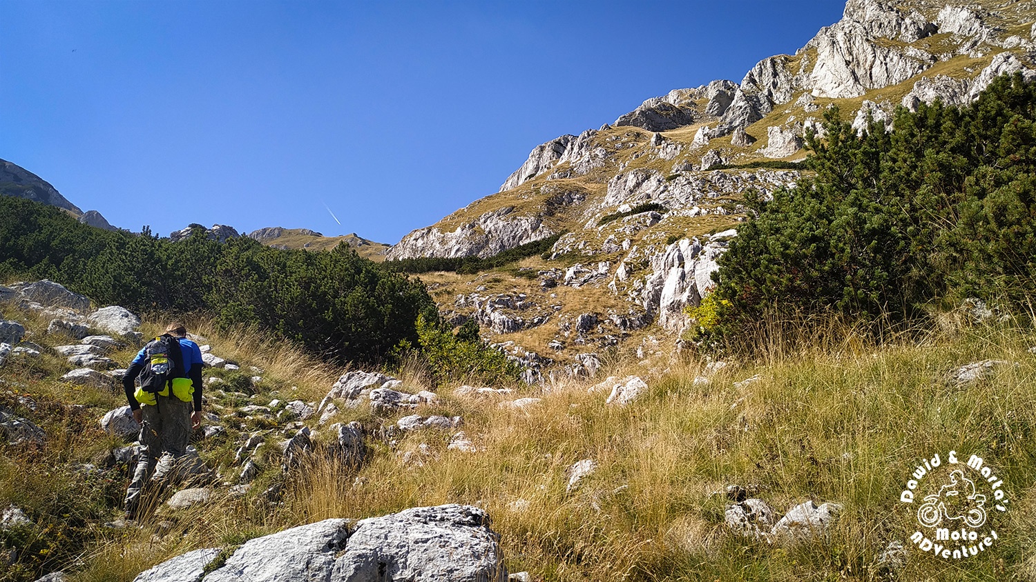
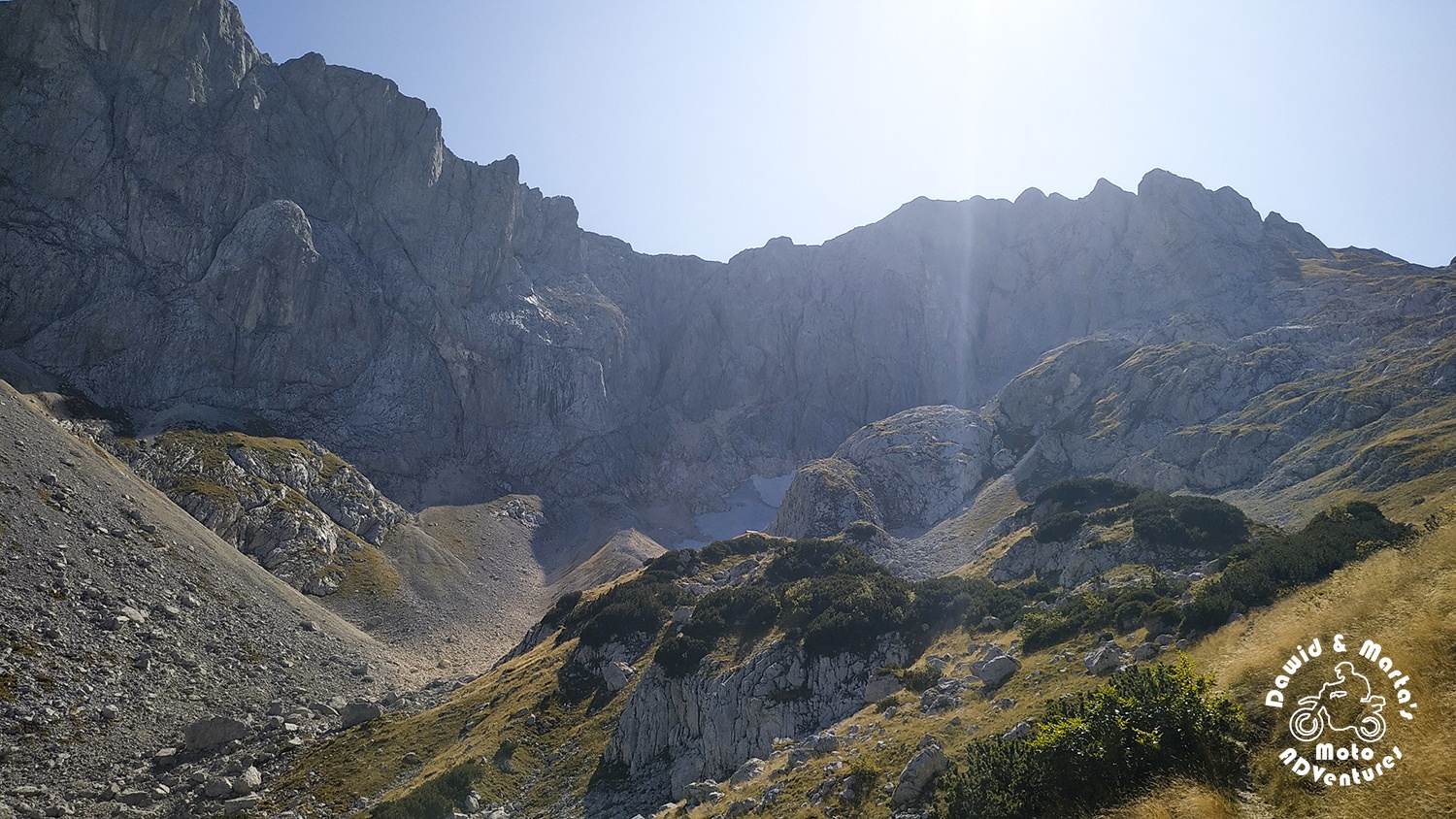
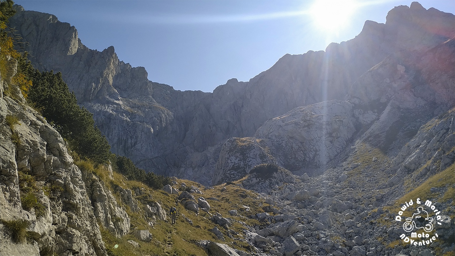
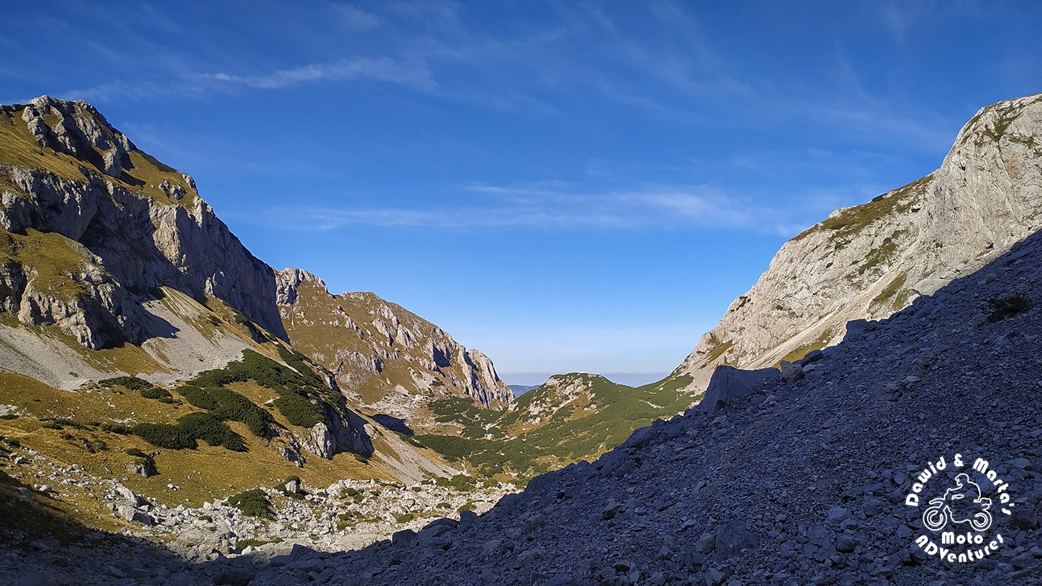
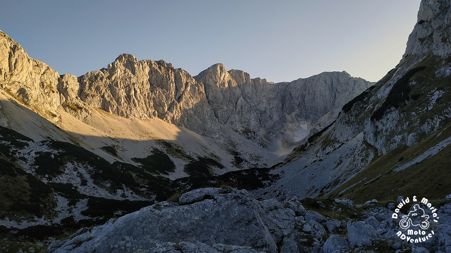
Through Previje pass to Velika Kalica valley
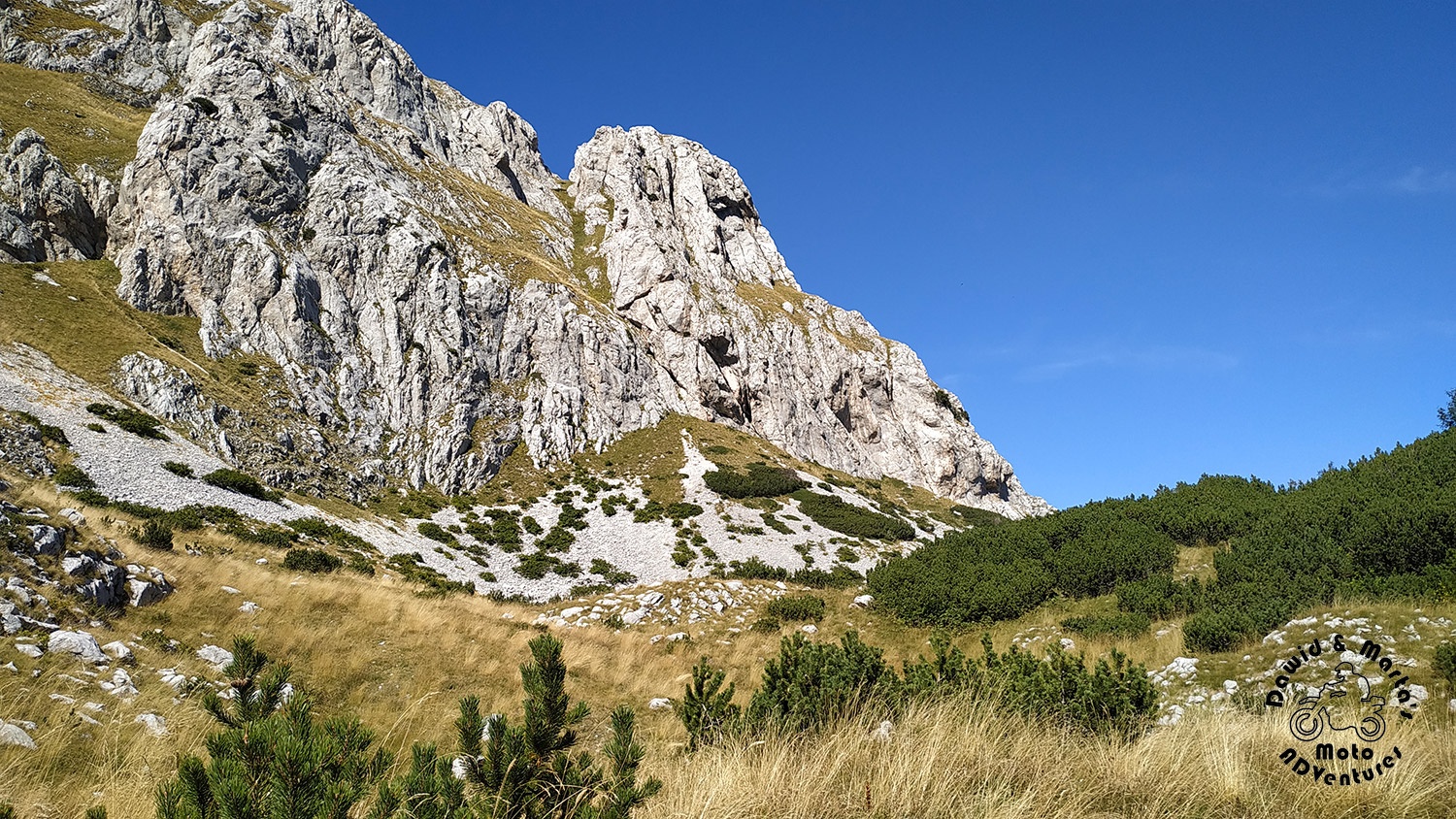
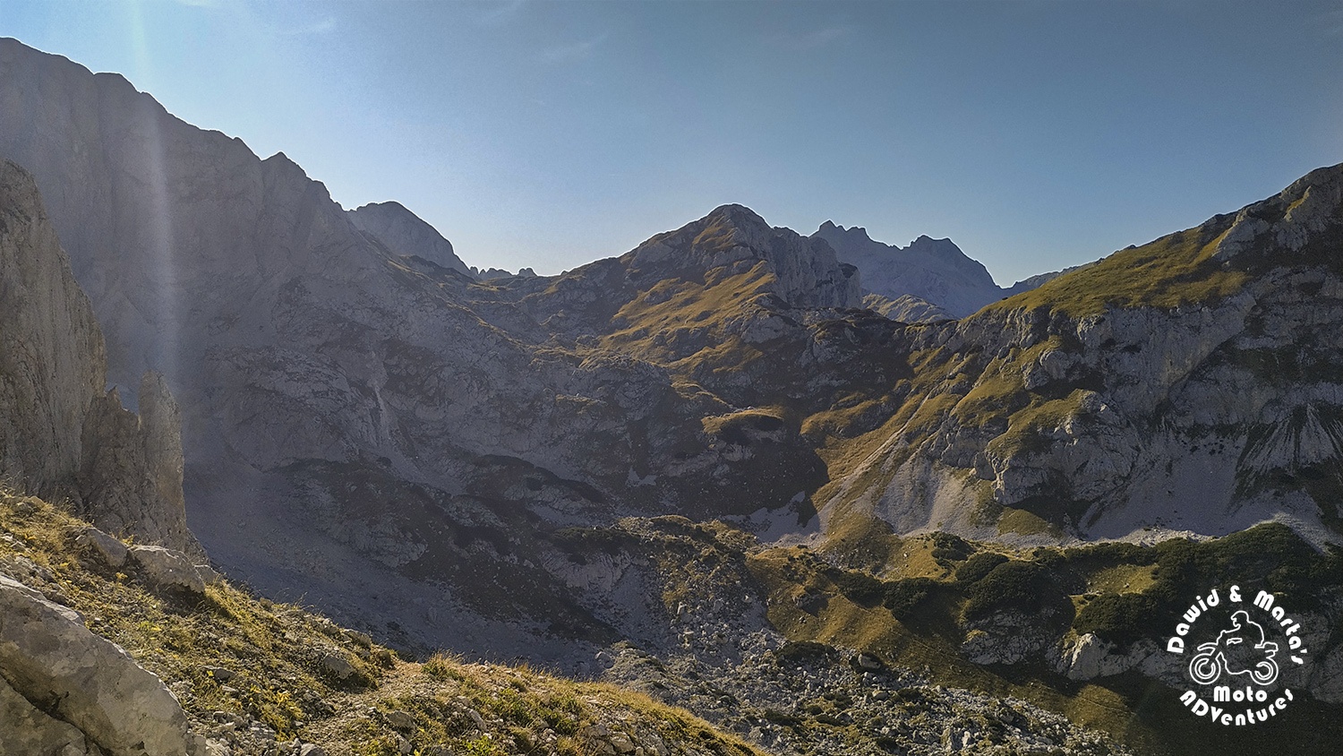
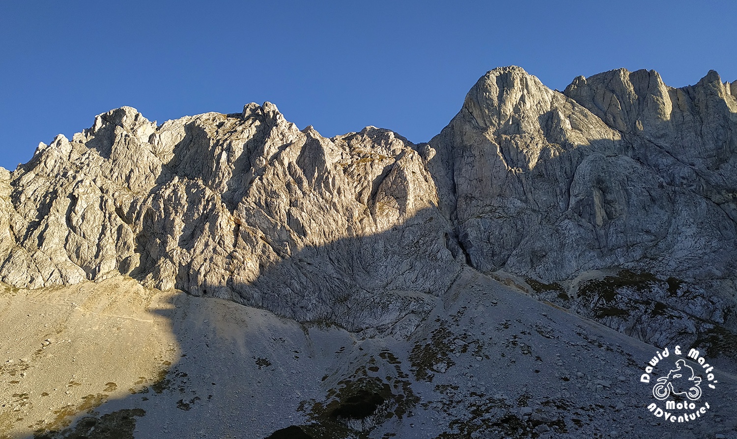
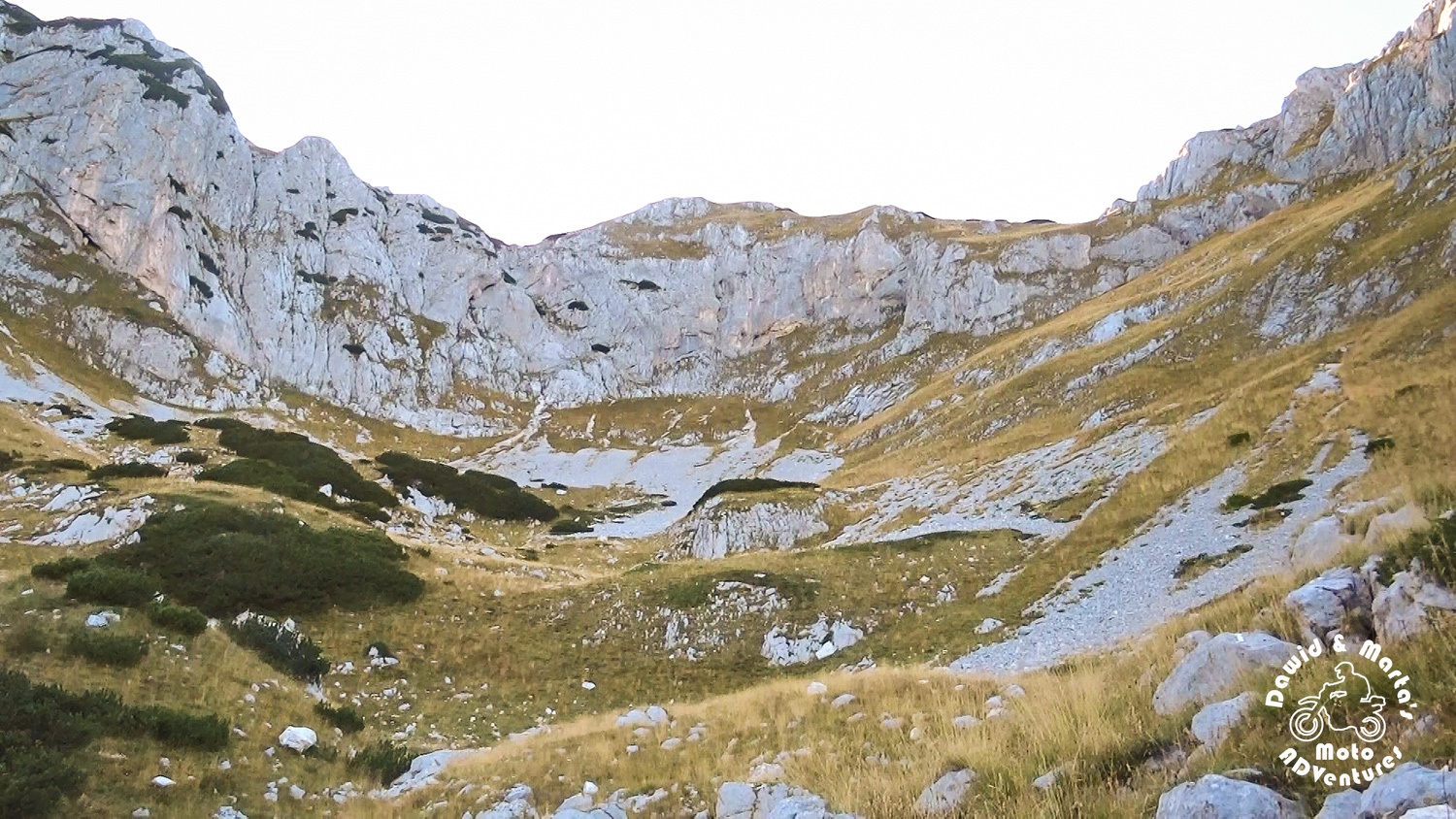
After crossing Struga pass, we moved to Previje pass not changing altitude much. We just go further into the amphitheater-like Velika Kalica valley, walking up closer to the observing us stone giants, basking their crests in the chilly Autumn sun.
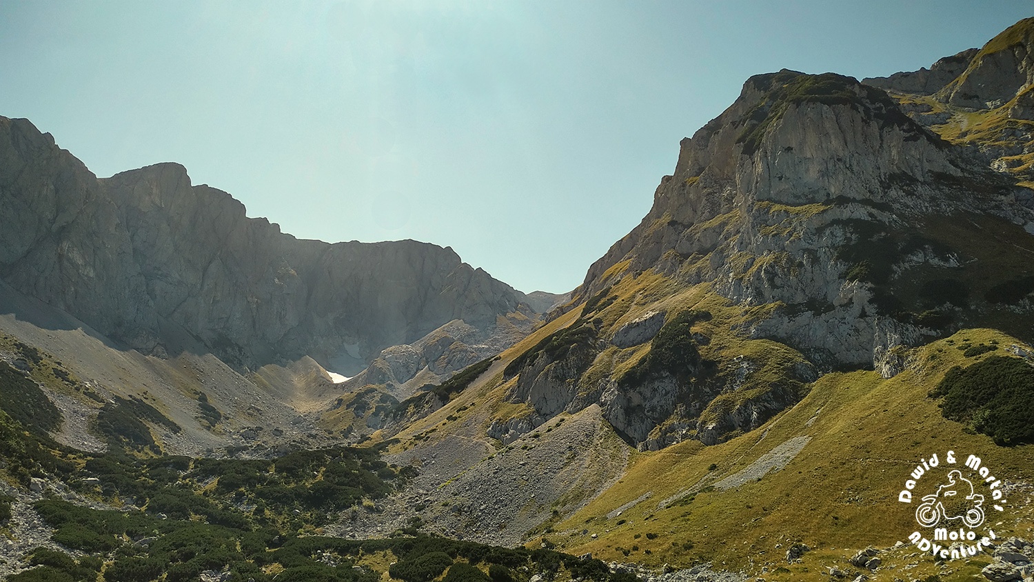

The valley’s walls are guarded by four mountain peaks. The western wall of the valley is guarded by 2303 m a. s. l. high Terzin Bogaz, the northern one by 2285 m a. s. l. big Veliki Medjed, the southern – by 2455 m a .s. l. huge Sljemena and lastly Savin Kuk closes the valley a little on the east.
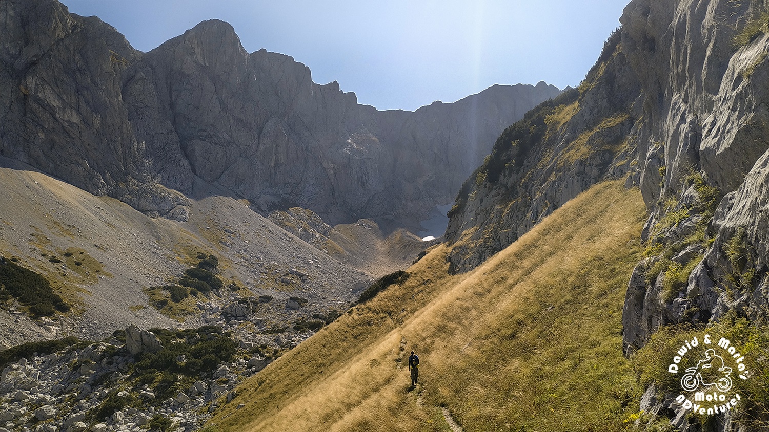
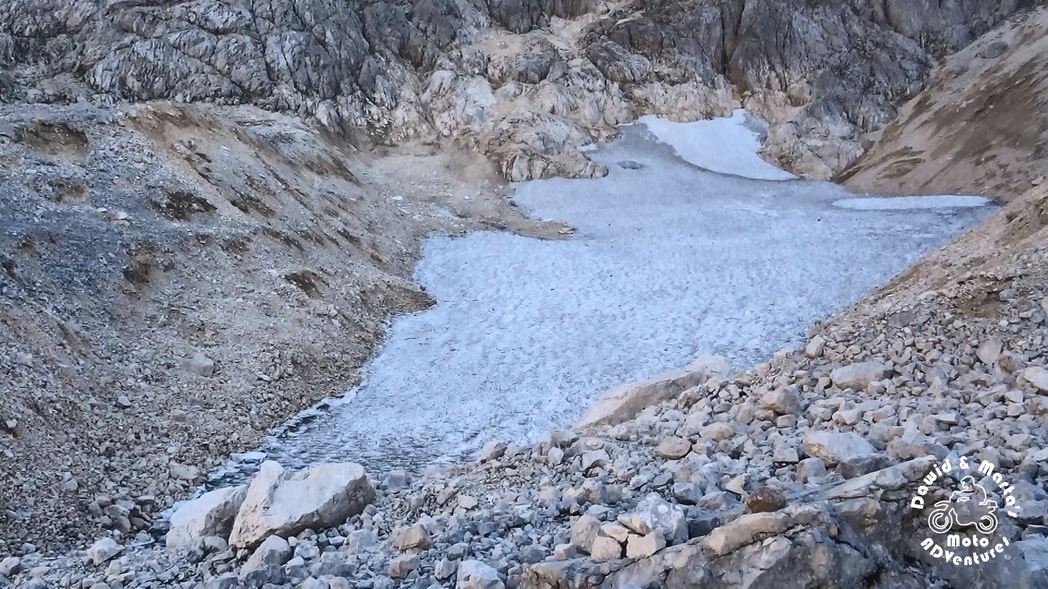
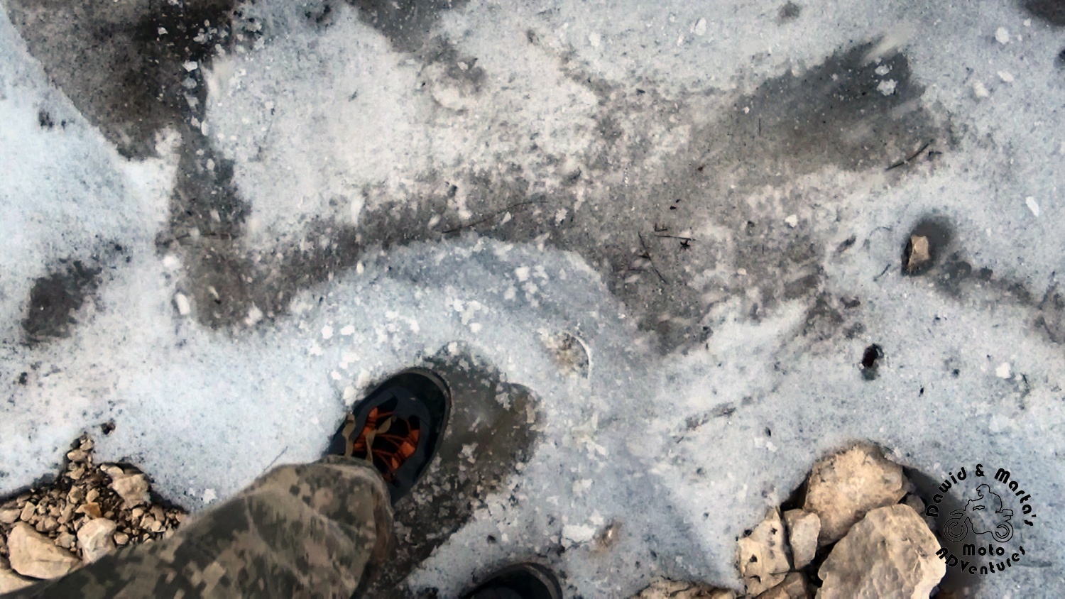
Almost at this valley’s dead end, resting in the mountains shade, lies a large snow field, visible even from the valley’s entrance.
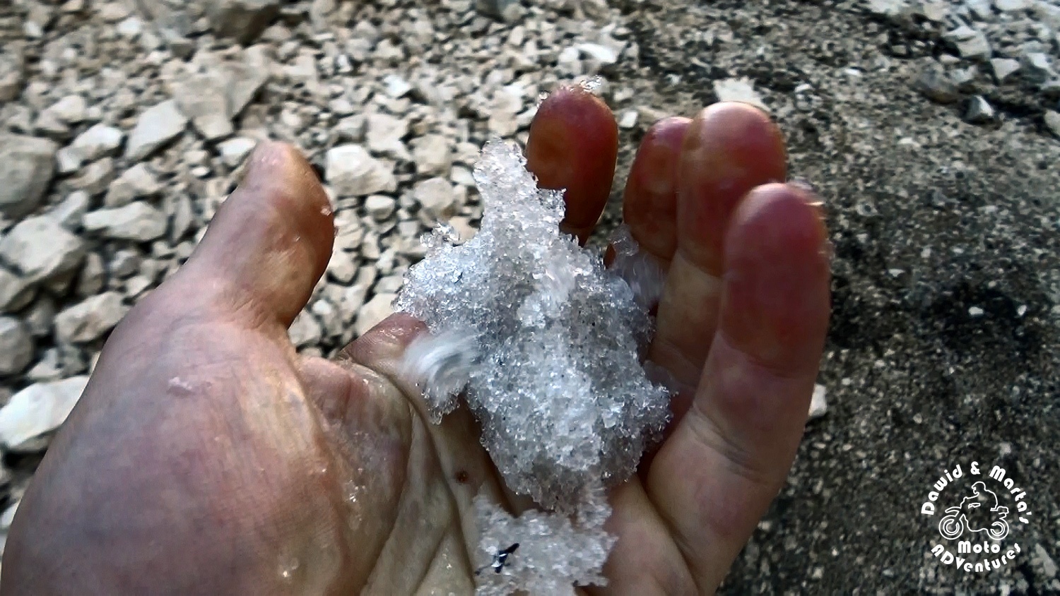
The snow is actually not your ordinary snow, as we learnt later, but it is a remnant of the glacier, which formed the valley. It even has a name! Debeli Namet. Which literally means… big drift ;)
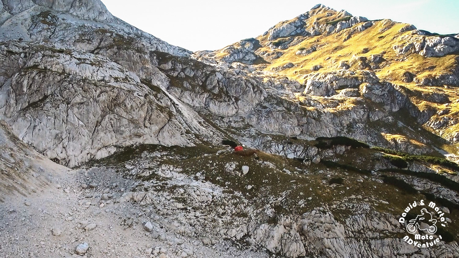
Apart from the glacier’s leftovers, we found a small shelter placed above the trail for tourists and skiers. It was marked as Alpinski bivak or bivuoac at all maps we had, even the paper one, so we expected to see something here, but we hadn’t known, how this asylum will look like.
It turned out to be a simple, red, tin container.
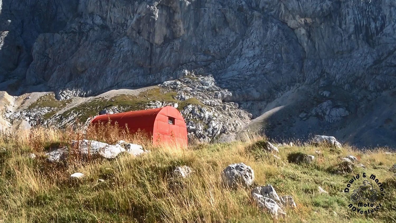
We took a look inside just out of curiosity as the doors were open.
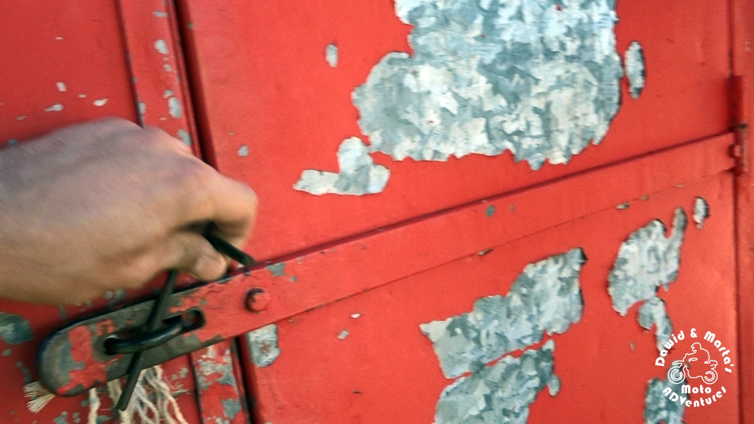
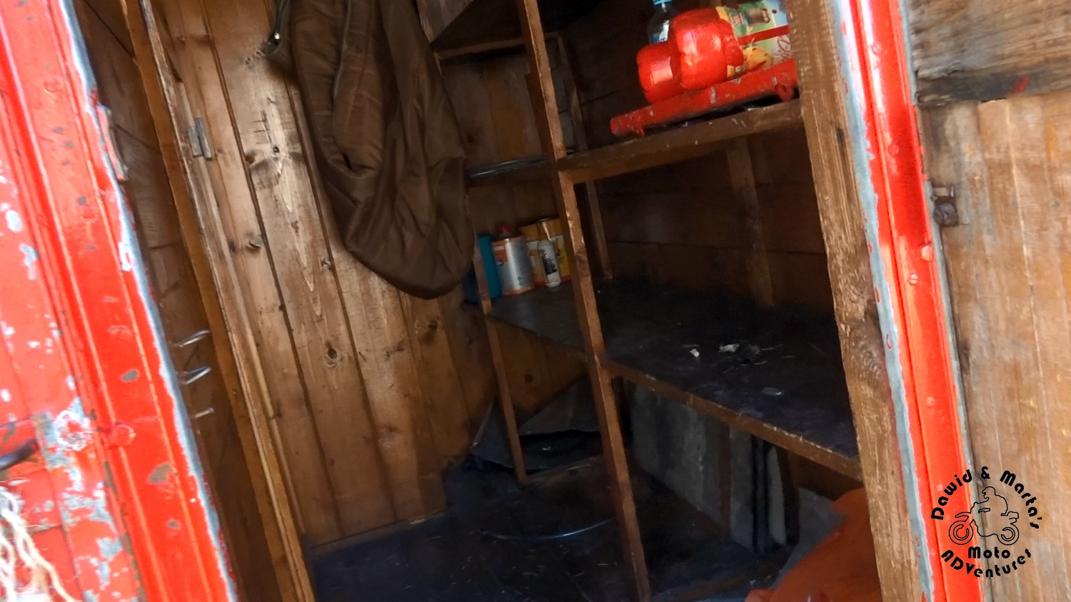
Unfortunately, the second doors were closed. That left us puzzled a little. We started to wonder and freak out if someone closed himself there and just… died…? Or someone just took over the place and got up for hiking.
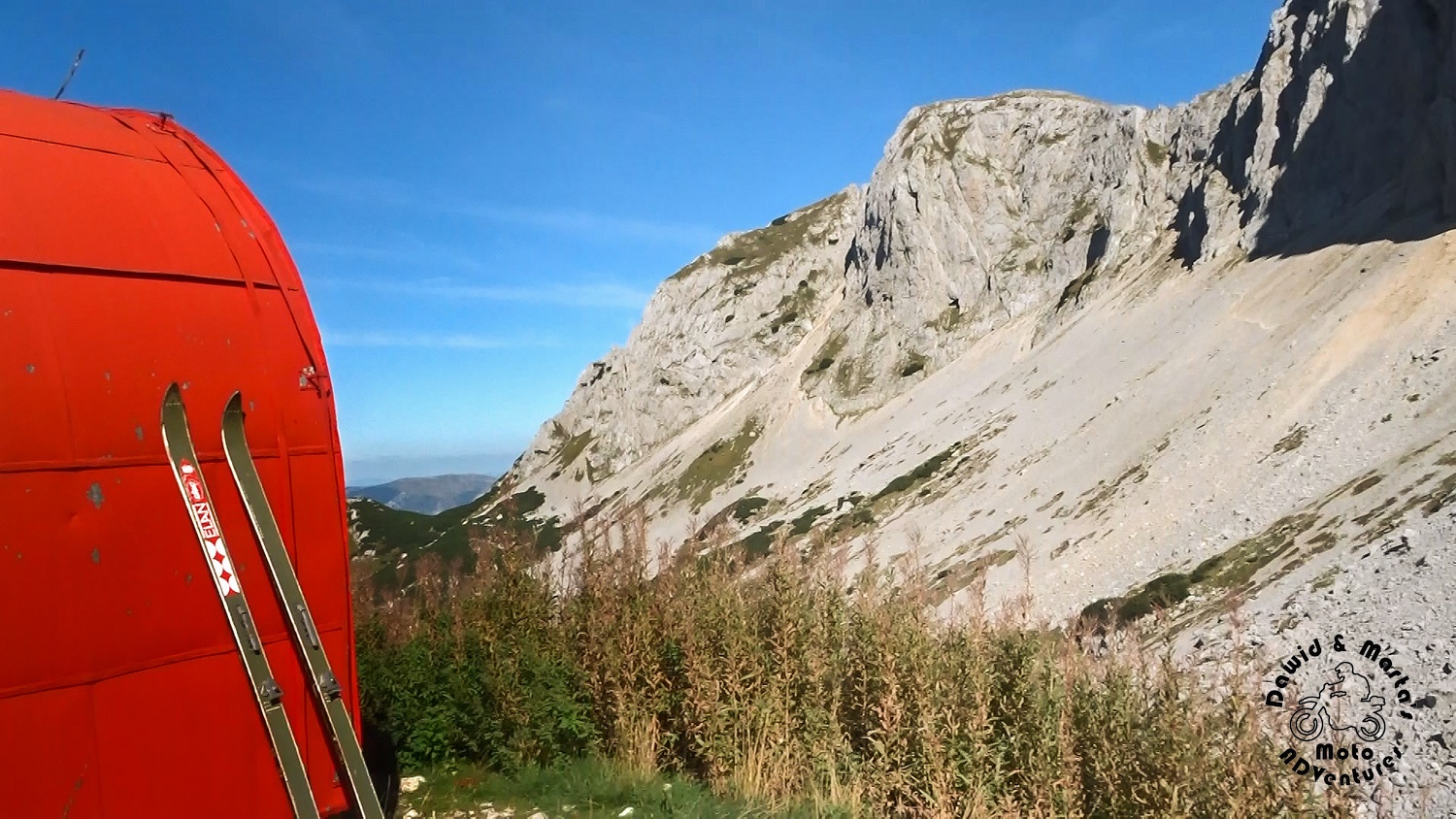
What was also strange – someone left his skis just like that, leaning on the container wall.
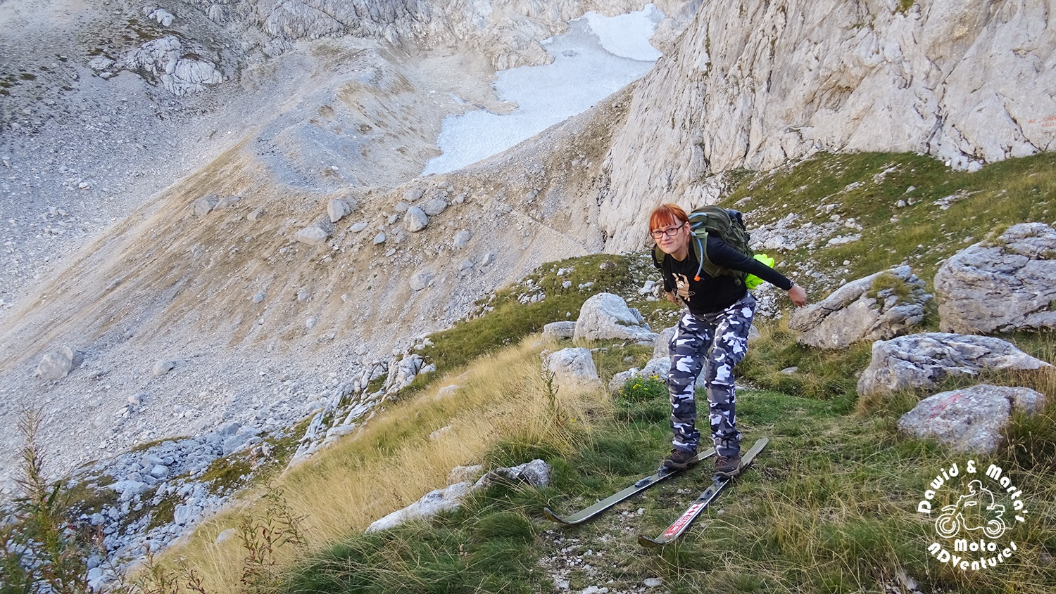
But there wasn’t any chance to know the story behind the skis nor behind the closed doors at that moment. We usually don’t carry any crowbars with us ¯\_(ツ)_/¯ And we didn’t have any urge to sleep there that day. Though we didn’t see anyone anywhere. We passed by maybe four people on our way to the valley.
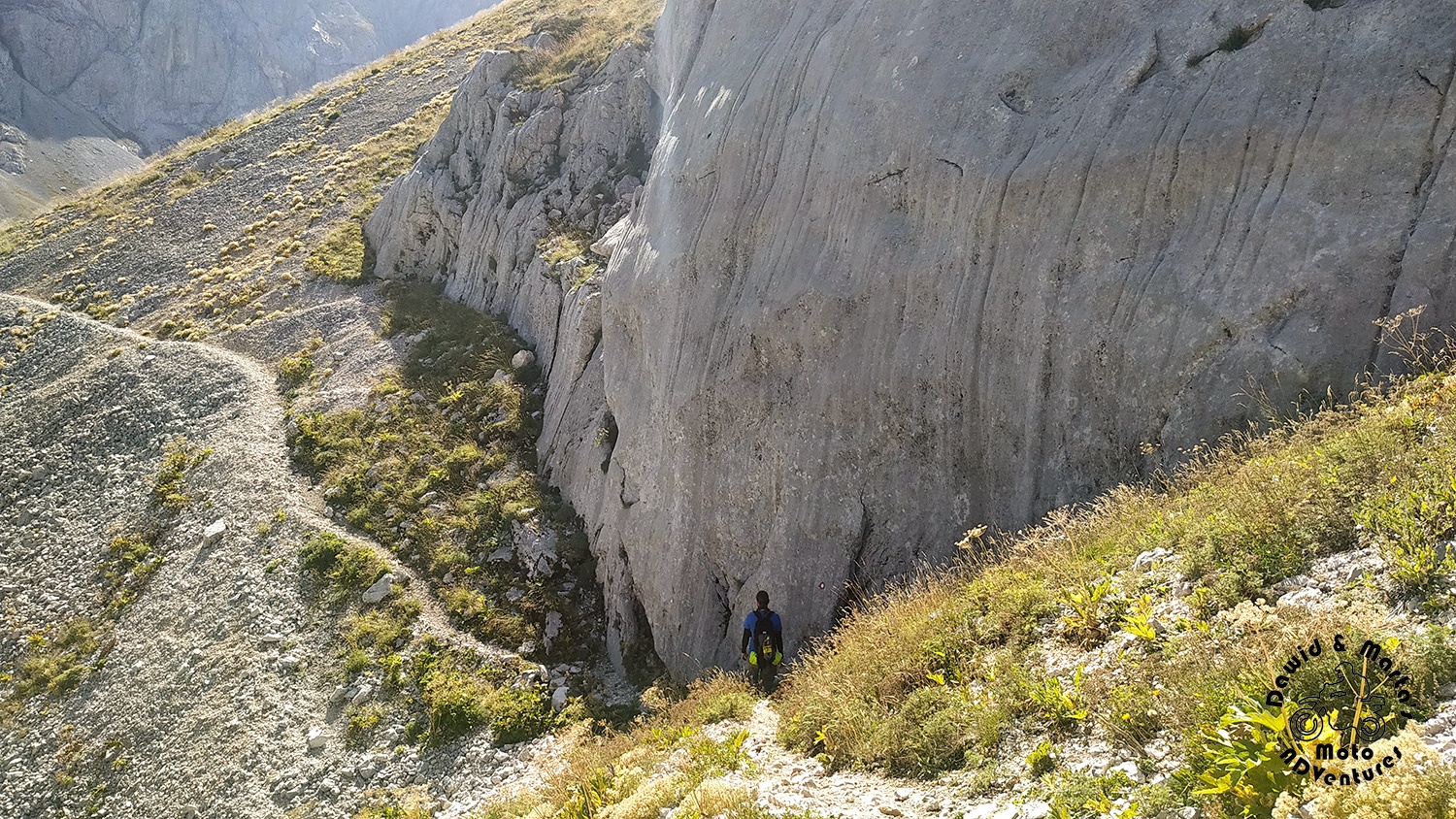
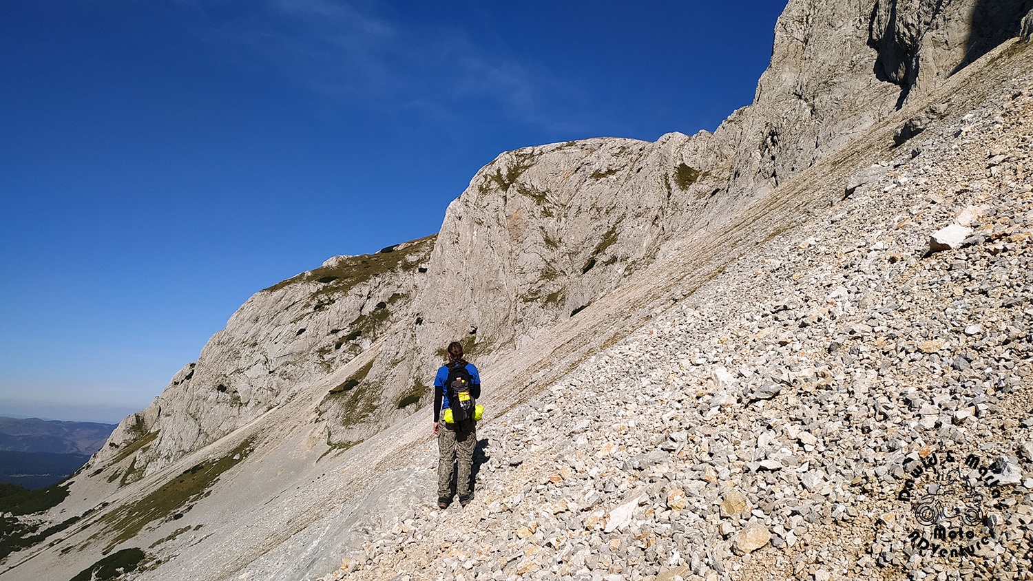
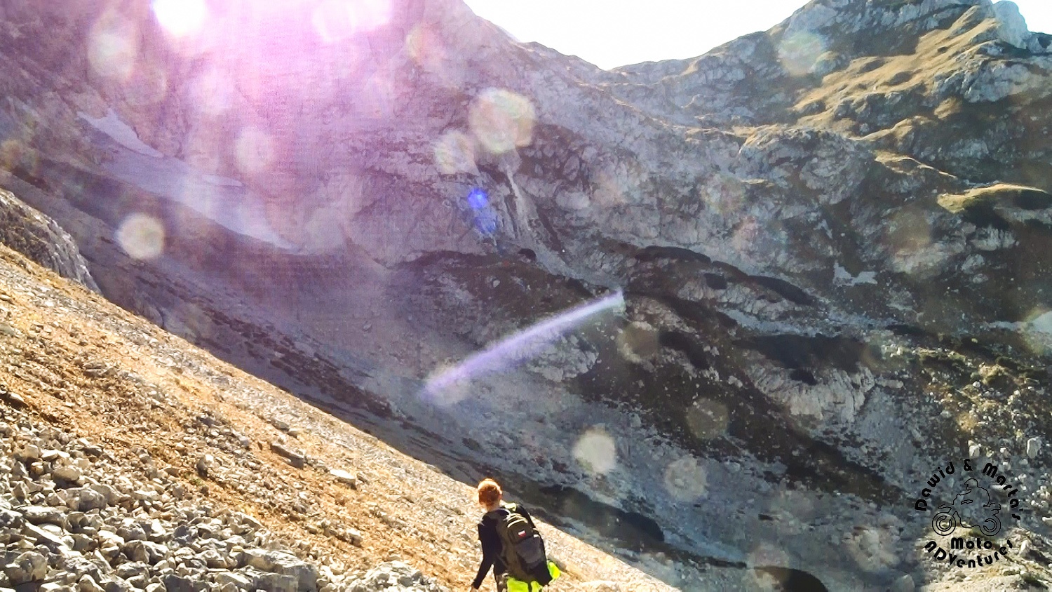
From Alpinski Bivak we headed out towards Savin Kuk. According to the map, we should have gone up the steep scree and traverse it back in the valley’s mouth direction.
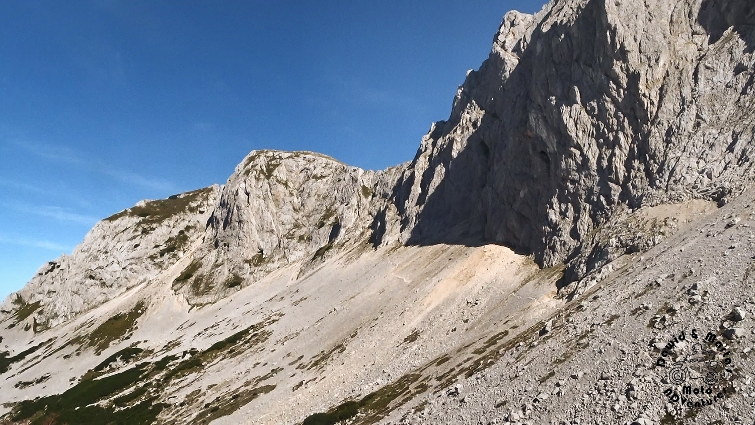
This wasn’t a trail we imagined it will be, it doesn’t look like a civilized and safe one, but well…
We decided we can’t retreat now and, as it was already 3 PM, we rushed a little, because soon enough sun would go down and we didn’t want to be caught by darkness is some uncomfortable spot.
Climbing Savin Kuk from Velika Kalica valley
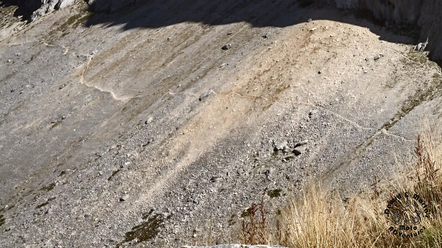
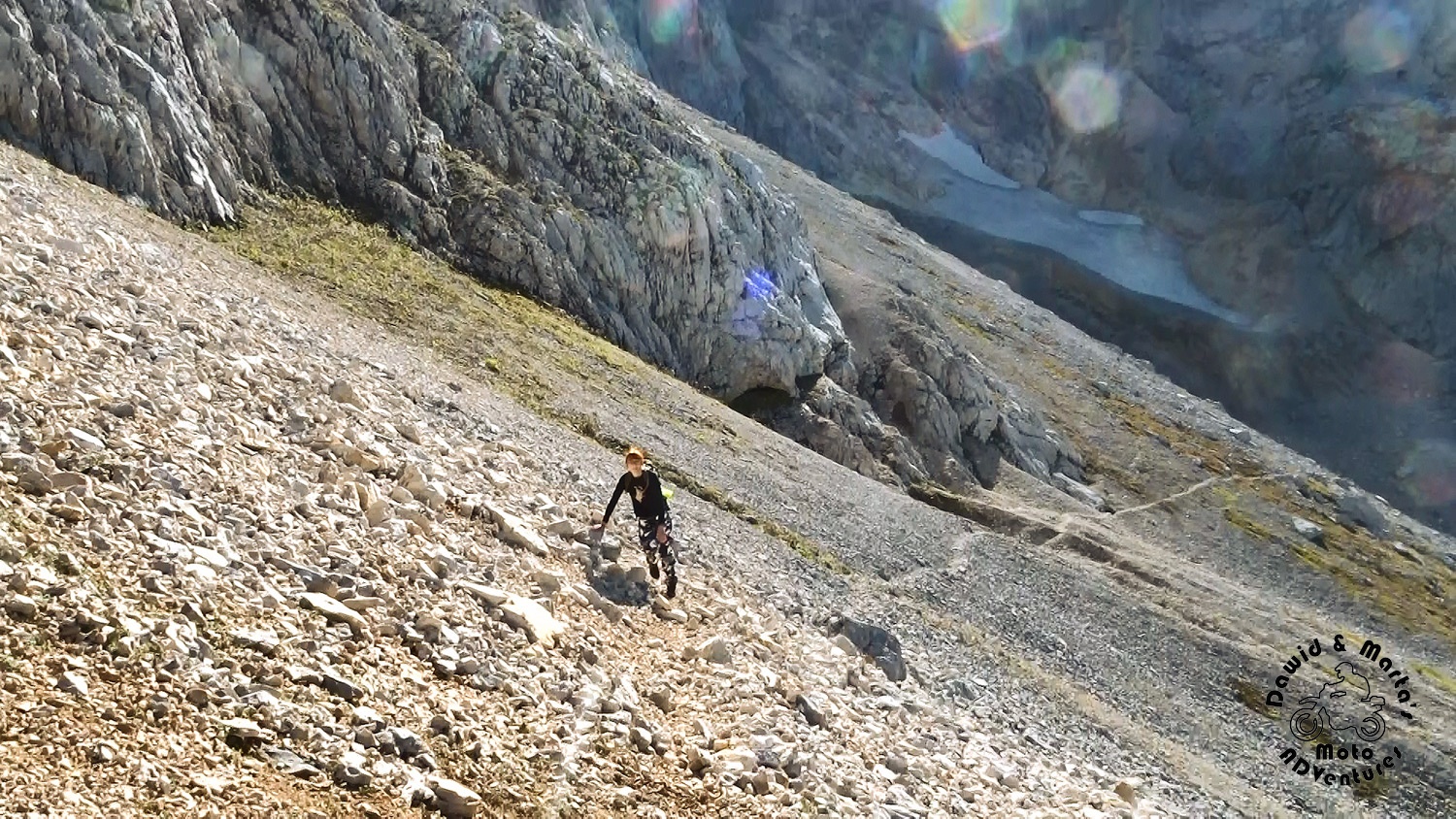
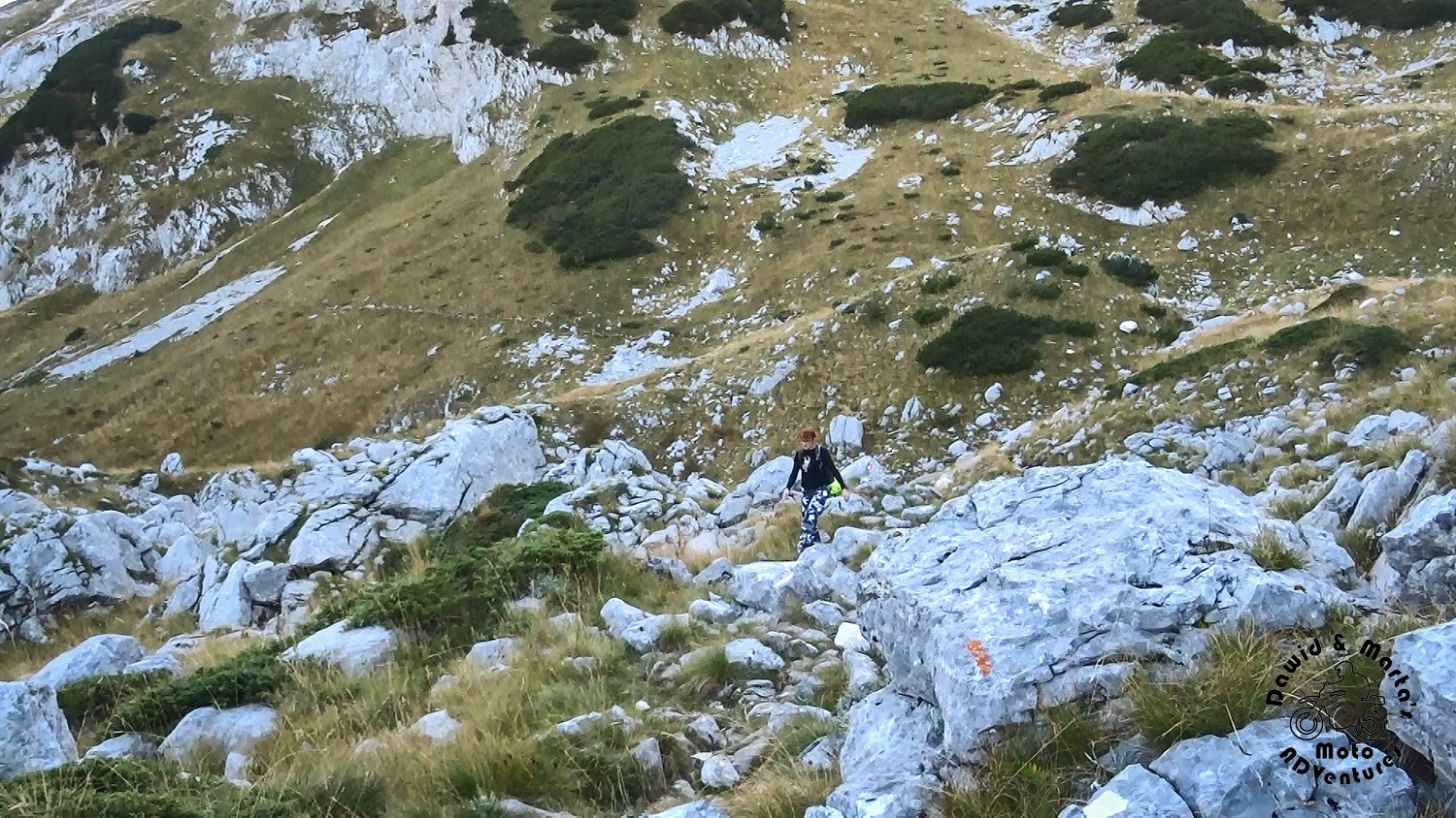
So we started forcing our way through the stone rubble up, although we couldn’t see any path leading up to the Savin Kuk top at the scree very bottom
So at first we were marking out our own trail, just trying to reach the thin line at the scree top we were seeing, while we were standing at Alpinski Bivak.
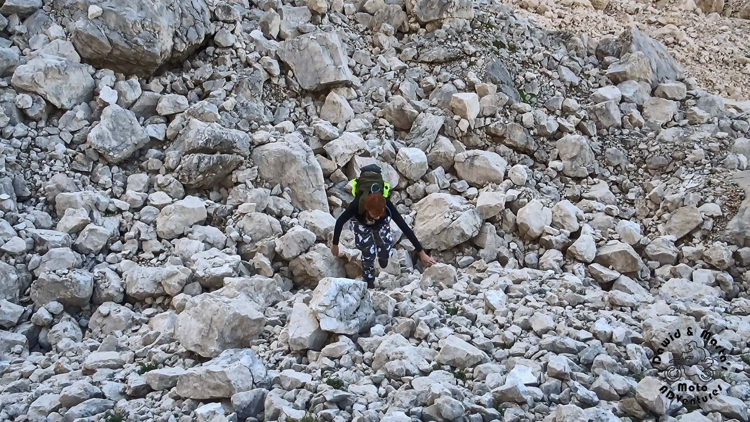
It looked like the path at the top is close, but it really wasn’t. It took us a while to get there.
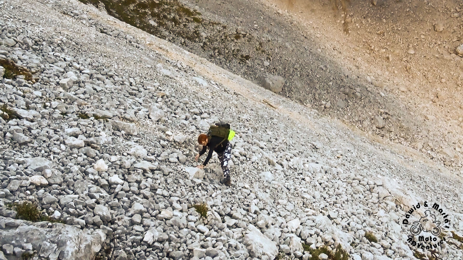
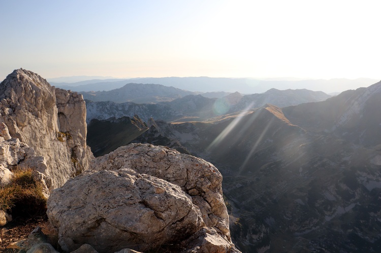
But when we were looking what’s behind our backs sometimes, all the effort felt rewarded.
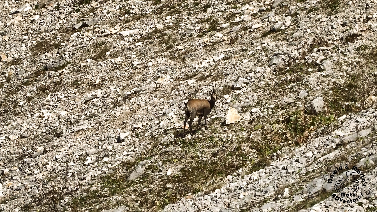
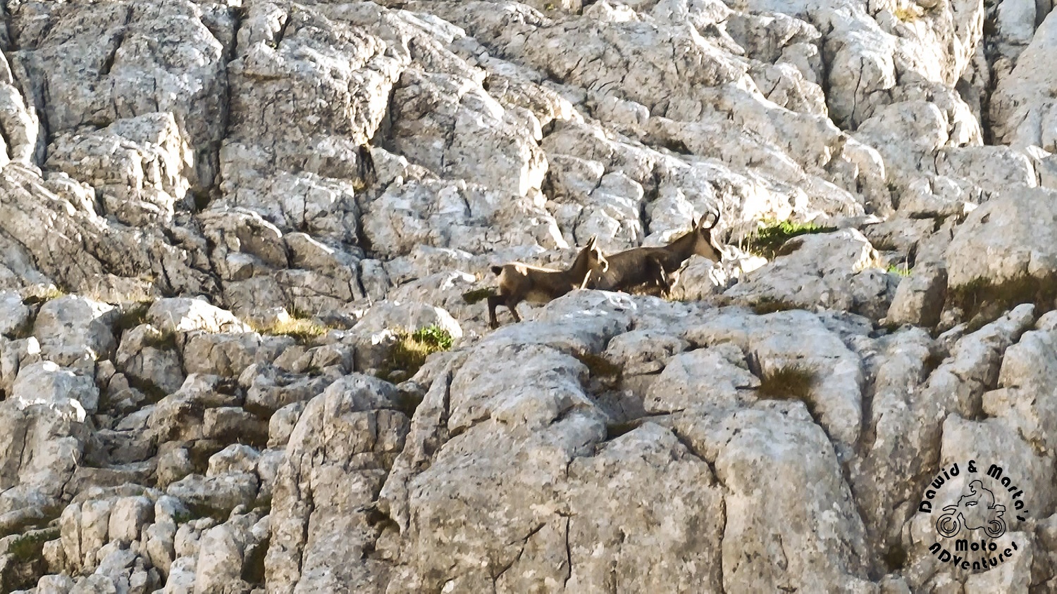
It was a little strange we stopped meeting other tourists, but we weren’t all alone, really. Chamoises kept us company. At some distance of course. They are rather shy ;) But it was fun to watch how they get wherever they want to through stone ledges, making huge jumps effortlessly.
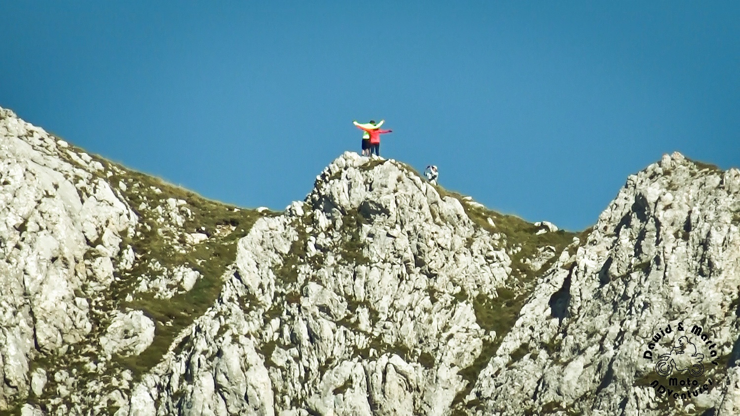
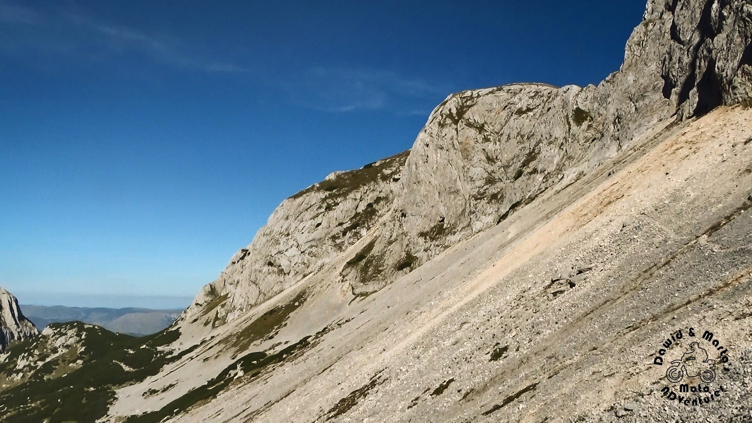
We reached the mountains crest at 4PM.
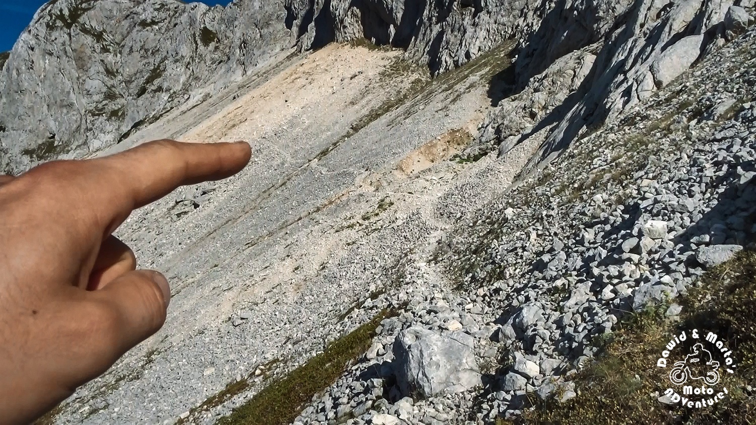
We just had to walk around some bigger stone, lying at the mountains crest bottom. Behind that stone we should start our last trail stretch left to cover to get to the Savin Kuk top. Right? Well…
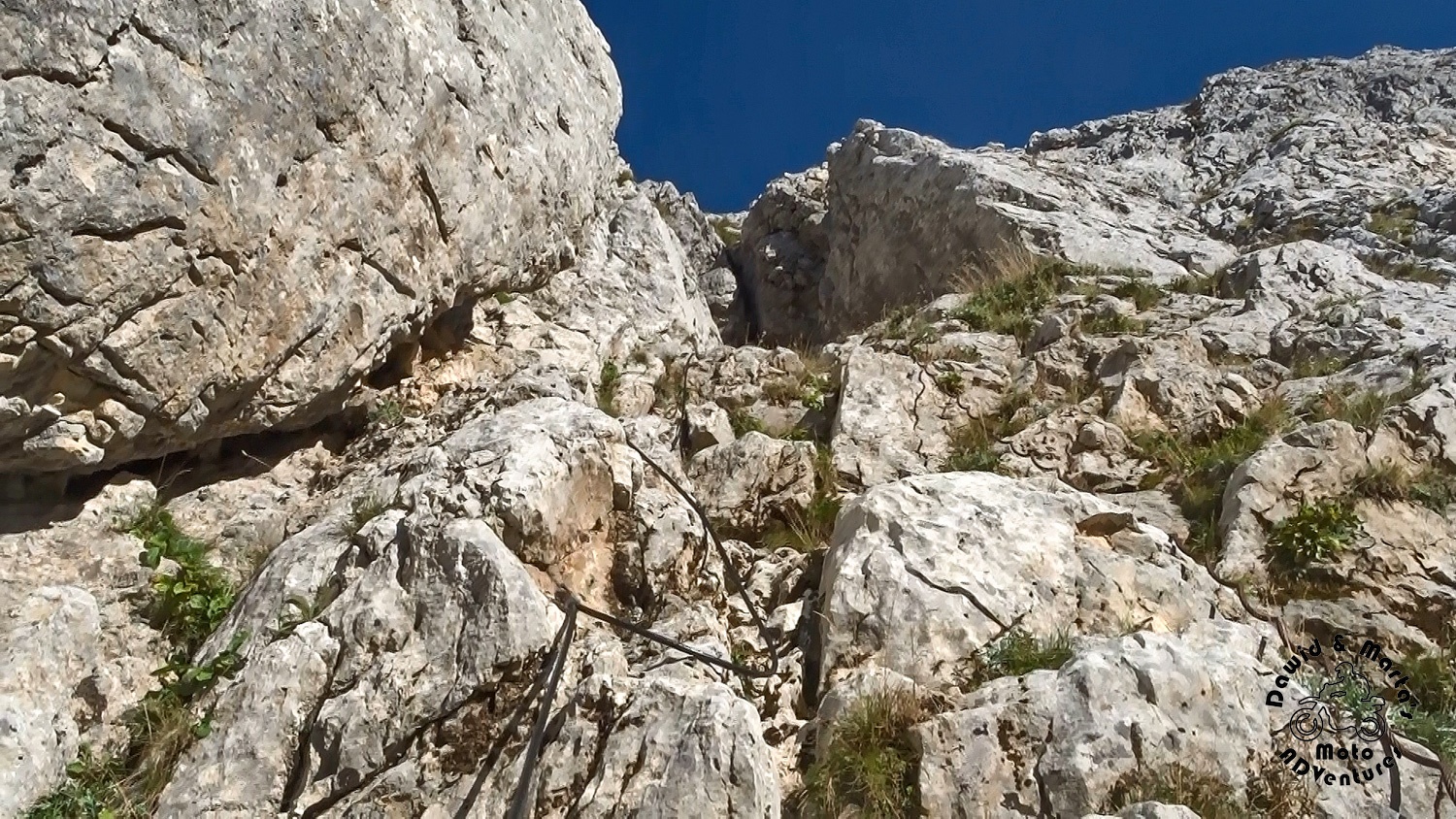
It turned out that the way to the Savin Kuk’s top is rather inconvenient. Only for the bold ones and rather for those, who have climbing ropes or no self preservation instinct. It’s plain climbing up the stone wall.
We thought to ourselves it’s a pity, but we backed away from idea of hiking further. We are not experienced in such tracks, had no equipment and no confidence if the trail is in fact passable and will lead us straight to the Savin Kuk’s top. Remeber?
There were no signs on the trail and no evidence of the trail existence on Durmitor maps for tourists. We just found this on mapy.cz page, where anyone can add anything. So we started to wonder if just some alpinist didn’t mark this trail.
But anyway, we gave up. It was too dangerous to try. The wall was dozens or hundreds of meters high still, so one bad move and we would have turned into a mush weathering forgotten on the scree bottom.
But do we regret all this long hiking?
No! \(◉ᗜ◉)/
We would regret painfully if we wouldn’t try! The views were totally well worth the whole time and power we sacrificed to get there. Never seen landscapes like those before. Never felt this mystic force of silent mountains more intensely than there, just sitting on the scree top in the last rays of sun, looking in the silent, empty valley and at close, but unapproachable mountain tops.
After short chilling and drinking in the views we started to move back to Alpinski Bivak.
When we were walking down, though, we started to notice quite well maintained rock towers marking the trail again. However, they were really hard to see in the scree full of other stones. But they definitely weren’t nature’s work. So all in all we weren’t the only one, who walked up this season.
From Alpinski Bivak, after a break for donuts, we traced back our footprints through Previje and Struga pass. It was nice to watch the sunlight play in the valley’s amphitheater, while the sun was setting to hide behind the mountains ridge. So the track back to Razvrsje wasn’t boring at all.
On the way through Struga pass, we met two ladies from Poland, who aimed for Alpinski Bivak, where they intendent to stay overnight. We thought this was very cool idea, though we told them that the room inside the shelter is closed… Hope you ladies survived in the vestibule and caught the sunrise ʕ•ᴥ•ʔ
A little lower we met some other Polish tourists again, which were staying in the tent for the night below the Struga pass. (Hope they had a good night, too ʕ•ᴥ•ʔ) It seems that hiding in Durmitor’s mountains for the night isn’t so unpopular idea. It is kind of heart-warming as we wanted to stay up in the Montenegro mountains one day too, so it looked like we’re not so crazy ;)
But that day we were politely walking down to our camping. No tent for us.
We got to the trail start, when it was already dark, though it was around 6.30 PM. So the whole trip took us around 7 to 8 hours, counting breaks.
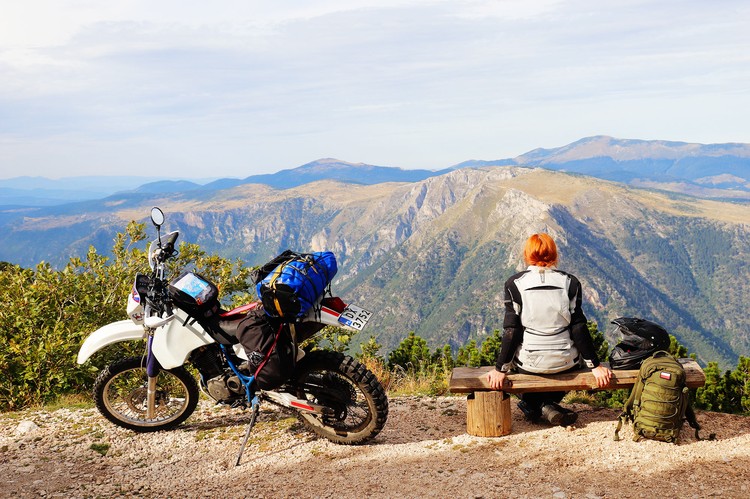
When we got to our camping, we just ate something warm and jumped into our sleeping bags. We were really tired and the next day we were also letting our bikes rest as we were planning to attack the Durmitor’s highest mountain – Bobotov Kuk.
Get this adventure too
If you also want to try this hiking option, the trail is down in the Ride it too section (although, remember, it's not ridable ;))
Or at least try this trail with us in our video ;)
Comments